Select Item below to DOWNLOAD - Once item is selected, right click and choose 'save as'
722d8f5315e3486eb9d073cf162281e2
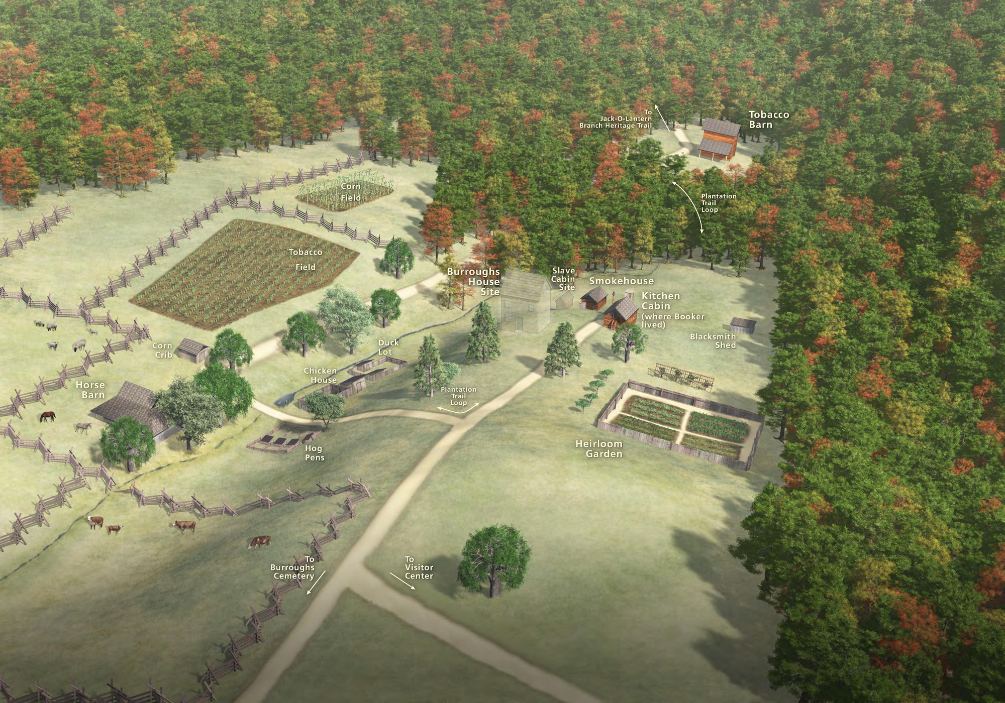
3D Oblique Map - Booker T. Washington National Monument
3D oblique map of Booker T. Washington National Monument in Virginia. Buildings are rendered in perspective on a grassy hill, and green, orange, and yellow-toned trees fill in the top and right edges of the map.
Screen-viewable file; Adobe print production files can be downloaded from the Compressed zip Version link
Map Projection: 3D; Map Type: other
U.S. National Park Service
The National Park Service maps are government produced and are in the public domain. Anyone may, without restriction under U.S. copyright laws: Reproduce the work in print or digital form; Create derivative works; Perform the work publicly; Display the work; Distribute copies or digitally transfer the work to the public by sale or other transfer of ownership, or by rental, lease, or lending. Please note, a user who modifies and/or republishes National Park Service maps are responsible for any problems encountered with the maps, due to their change or modification.
Public domain
Document
Booker T. Washington National Monument, Code: BOWA
Booker T. Washington National Monument, Franklin County, Virginia
Latitude: 37.1147994995117, Longitude: -79.7319030761719
Latitude: 37.1147994995117, Longitude: -79.7319030761719
2018-06-15
Public Can View
Person: Harpers Ferry Center
Organization: US National Park Service
Address: Harpers Ferry Center, Harpers Ferry, WV
Email: HFC_Cartography@nps.gov
Organization: US National Park Service
Address: Harpers Ferry Center, Harpers Ferry, WV
Email: HFC_Cartography@nps.gov
Friday, April 22, 2022 8:49:22 PM
Friday, September 26, 2025 11:34:14 PM
BOWAmap3.pdf
pdf
2.4 MB
Map