Select Item below to DOWNLOAD - Once item is selected, right click and choose 'save as'
708f73b3-46cb-42cf-afff-dcab896c362a
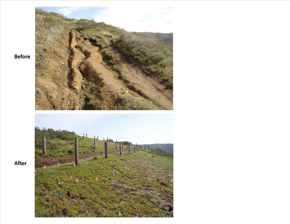
Realignment of Dias Ridge Trail
This project will improve the Dias Ridge Trail alignment and drainage to reduce erosion on Dias Ridge between the National Park Service, California State Parks, and the Golden Gate Dairy boundaries on State Highway 1 to protect the endangered species habitat of Redwood Creek. On Golden Gate National Recreation (GGNRA) lands, the project will restore 1.2 miles of poor existing trail alignment to natural conditions, including extensive revegetation, and construct 1.5 miles of new sustainable multi-use trail with proper drainage features, necessary retaining walls and a multi-use trail bridge.
New Trail Before and After
Permission must be secured from the individual copyright owners to reproduce any copyrighted materials contained within this website. Digital assets without any copyright restrictions are public domain.
Public domain
Image
Golden Gate National Recreation Area, Code: GOGA
Dias Ridge Trail, Golden Gate National Recreation Area, California
Latitude: 37.8916893005371, Longitude: -122.635803222656
Latitude: 37.8916893005371, Longitude: -122.635803222656
01/01/2009 - 12/30/2011
Public Can View
Tuesday, June 26, 2012 3:26:27 PM
Wednesday, August 9, 2017 11:17:26 PM
GOGA-3bce6f1258894a7fbd7ccf6c8d089ab2.jpg
Monday, January 1, 0001 12:00:00 AM
jpg
571.6 kB
Inventory
,
Budget