Select Item below to DOWNLOAD - Once item is selected, right click and choose 'save as'
6cb28a8c-abd2-4a96-9b3a-a0cec480e25d
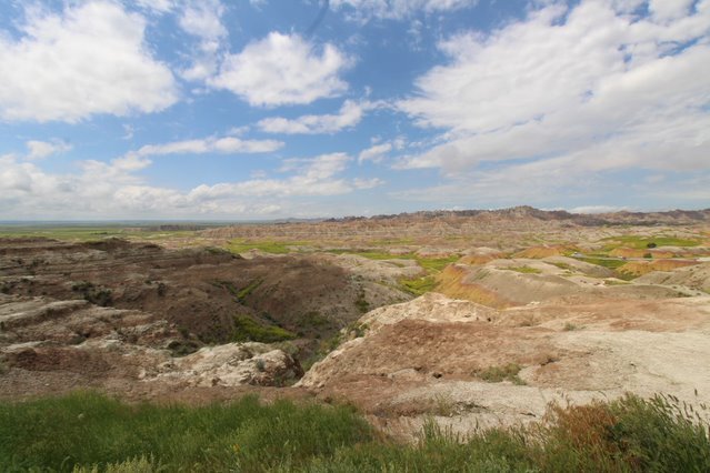
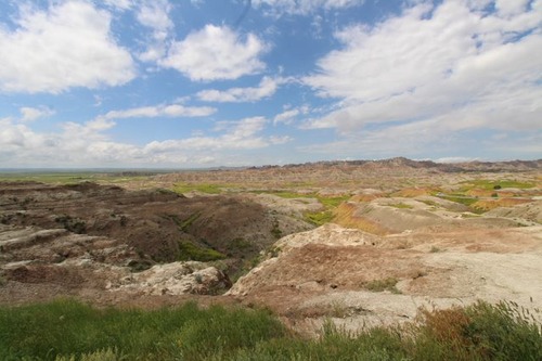
Conata Basin Overlook
yellow, red, and brown buttes leading down to a grassy valley with higher buttes on the horizon
Conata Basin, the basin pictured here, contains much of the park's Black-footed Ferret population, an endangered species which the park works to protect.
Permission must be secured from the individual copyright owners to reproduce any copyrighted materials contained within this website. Digital assets without any copyright restrictions are public domain.
NPS / Brad Barker
Public domain:Full Granting Rights
Image
Badlands National Park, Code: BADL
Badlands National Park, South Dakota
Latitude: 43.8339996337891, Longitude: -102.393898010254
Latitude: 43.8339996337891, Longitude: -102.393898010254
01/01/0001
Public Can View
Friday, April 24, 2020 1:15:18 PM
Friday, April 24, 2020 1:15:18 PM
thumbnail (13).jpg
Monday, January 1, 0001 12:00:00 AM
jpg
59.7 kB
Scenic