Select Item below to DOWNLOAD - Once item is selected, right click and choose 'save as'
6c281fdf-6a27-457a-9a56-1c7ee6efffdf
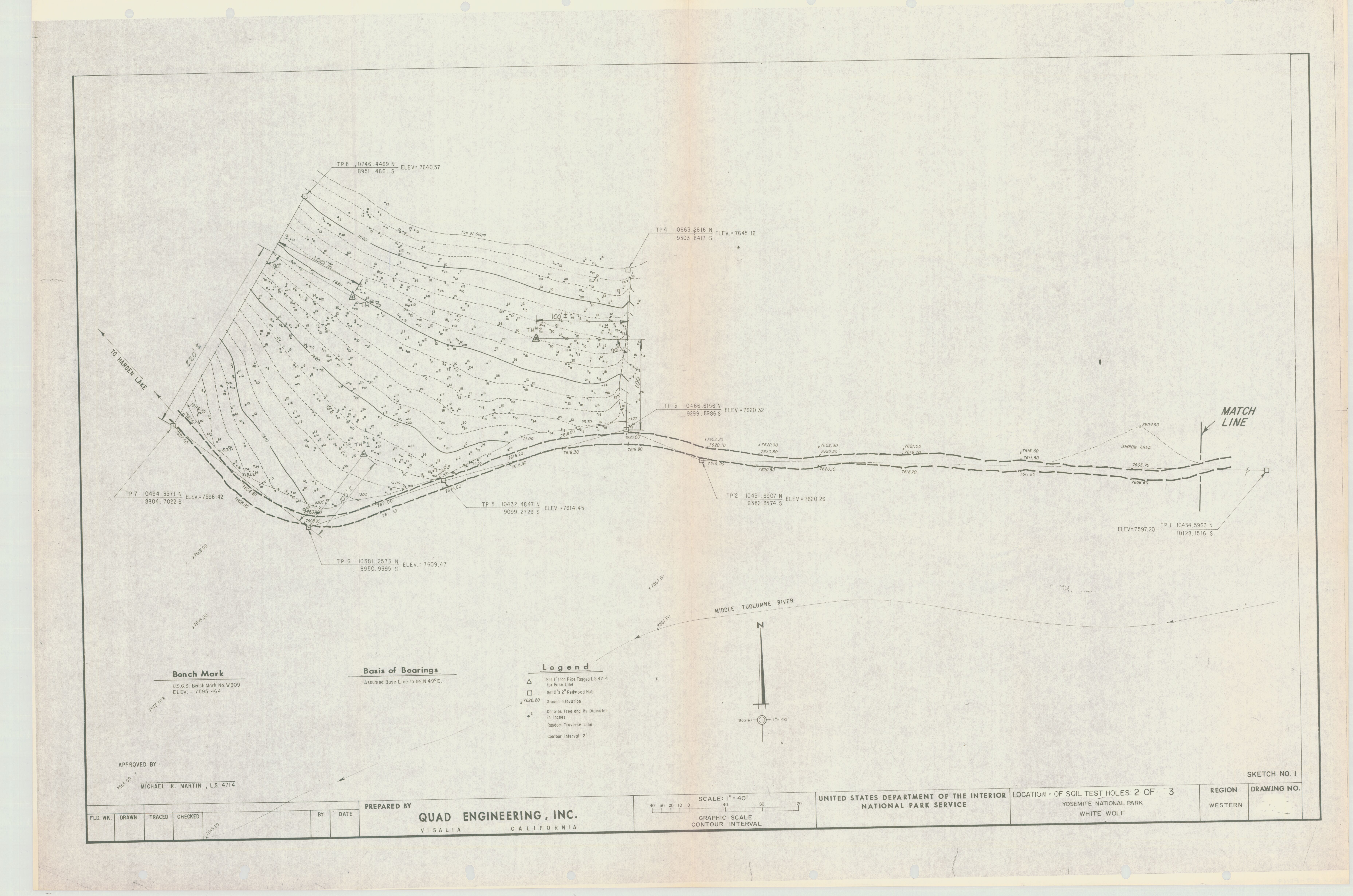
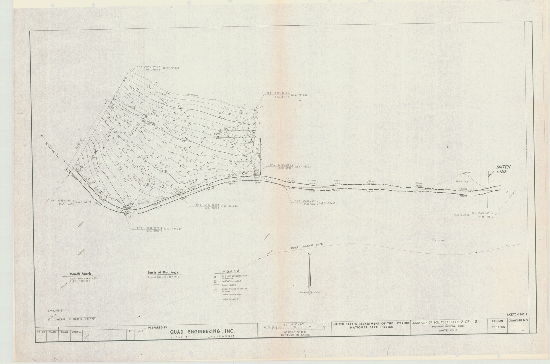
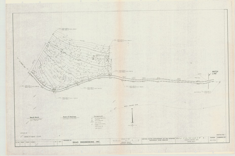
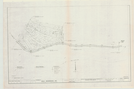
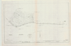
Location of Soil Test Holes Yosemite National Park White Wolf
Location of Soil Test Holes Yosemite National Park White Wolf
Map showing road to Harden Lake and soil test holes
Item Number: YOSEAR000752B; AlternateId: 1002-009-F0169, Sketch no.1, 2 of 3
Contact Yosemite National Park for more copyright information and use
Public domain:This digital asset is in the public domain. When using this asset for any purpose, including online, credit:'Courtesy U.S. National Parks'
Image
Yosemite National Park, Code: YOSE
Yosemite National Park, California
Latitude: 37.8399200439453, Longitude: -119.540397644043
Latitude: 37.8399200439453, Longitude: -119.540397644043
Undated
Type: paper; Dimensions: 25 X 36.5; Condition: good
YOSE Location: E2 DR4 F6
Public Can View
Person: Archivist
Organization: US National Park Service
Address: Yosemite National Park Archives, PO Box 700-W, El Portal, CA 95318
Email: yose_archives@nps.gov
Organization: US National Park Service
Address: Yosemite National Park Archives, PO Box 700-W, El Portal, CA 95318
Email: yose_archives@nps.gov
Monday, July 25, 2022 10:00:09 PM
Monday, July 25, 2022 10:00:09 PM
YOSEAR000752B.tif
tif
61.9 MB
Scenic
,
Map