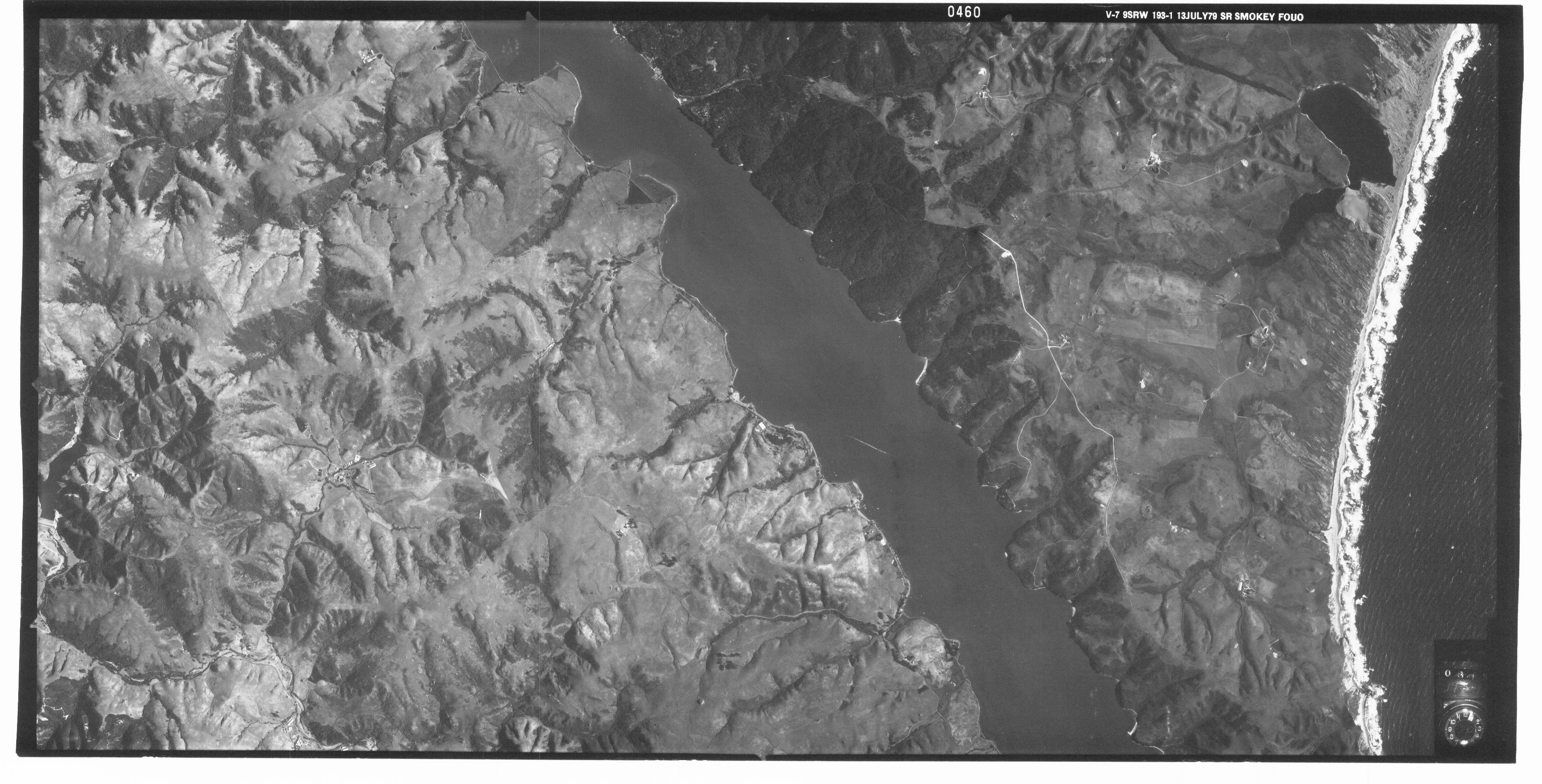
Latitude: 38.0550003051758, Longitude: -122.879997253418
Point Reyes National Seashore Coastal Aerial Survey, 1979 Part 3 of 3
Point Reyes National Seashore Coastal Aerial Survey, 1979 Part 3 of 3
Point Reyes National Seashore Coastal Aerial Survey, 1979 Part 3 of 3
Point Reyes National Seashore Coastal Aerial Survey, 1979 Part 3 of 3
Point Reyes National Seashore Coastal Aerial Survey, 1979 Part 3 of 3
Point Reyes National Seashore Coastal Aerial Survey, 1979 Part 3 of 3
Point Reyes National Seashore Coastal Aerial Survey, 1979 Part 3 of 3
Point Reyes National Seashore Coastal Aerial Survey, 1979 Part 3 of 3
Point Reyes National Seashore Coastal Aerial Survey, 1979 Part 3 of 3
Point Reyes National Seashore Coastal Aerial Survey, 1979 Part 3 of 3
Point Reyes National Seashore Coastal Aerial Survey, 1979 Part 3 of 3
Point Reyes National Seashore Coastal Aerial Survey, 1979 Part 3 of 3
Point Reyes National Seashore Coastal Aerial Survey, 1979 Part 3 of 3