Select Item below to DOWNLOAD - Once item is selected, right click and choose 'save as'
695cbebf-78d2-4796-9150-73a00cdf0daa
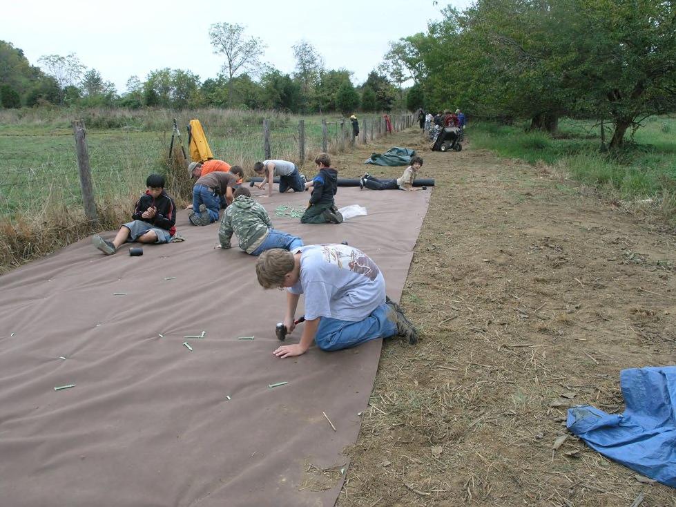
Public Lands Day project at the Miller Farm on Antietam National Battlefield; improving the riparian buffer.
Public Lands Day project at the Miller Farm on Antietam National Battlefield; improving the riparian buffer.
Permission must be secured from the individual copyright owners to reproduce any copyrighted materials contained within this website. Digital assets without any copyright restrictions are public domain.
Public domain
Image
Antietam National Battlefield, Code: ANTI
Miller Farm, Antietam National Battlefield, Washington County, Maryland
Latitude: 39.470100402832, Longitude: -77.7380981445313
Latitude: 39.470100402832, Longitude: -77.7380981445313
10/01/2008 - 09/29/2009
Public Can View
Friday, November 13, 2009 9:27:37 AM
Wednesday, August 9, 2017 10:34:44 PM
ANTI-43a172dc498e4c7e924933ab50c65607.jpg
Monday, January 1, 0001 12:00:00 AM
jpg
150.1 kB
Budget
Public Lands Day project at the Miller Farm on Antietam National Battlefield; improving the riparian buffer.
Public Lands Day project at the Miller Farm on Antietam National Battlefield; improving the riparian buffer.
Public Lands Day project at the Miller Farm on Antietam National Battlefield; improving the riparian buffer.