Select Item below to DOWNLOAD - Once item is selected, right click and choose 'save as'
6769bed94b2849ce9076826aa27bda37
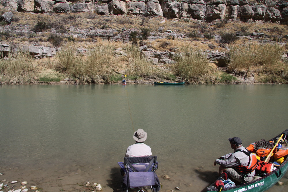
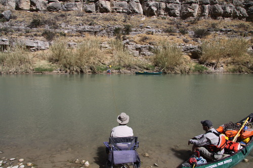
Lower Canyons. River Mile 708.6. March 2011.
Photo of the Rio Grande
Rio Grande vegetation monitoring, Lower Canyons photopoint at river mile 708.6, March 2011.
U.S. National Park Service
Permission must be secured from the individual copyright owners to reproduce any copyrighted materials contained within this website. Digital assets without any copyright restrictions are public domain.
NPS Photo
Public domain
Image
Big Bend National Park, Code: BIBE
Rio Grande Wild and Scenic River, Code: RIGR
Rio Grande Wild and Scenic River, Code: RIGR
Big Bend National Park, Brewster County, Texas
Latitude: 29.3278388977051, Longitude: -103.205894470215
Rio Grande Wild and Scenic River, Texas
Latitude: 29.3278388977051, Longitude: -103.205894470215
Rio Grande Wild and Scenic River, Texas
20110301
03/01/2011
Public Can View
Person: Resource Management
Organization: US National Park Service
Address: Big Bend National Park, P.O. Box 129, TX 79834-0129
Organization: US National Park Service
Address: Big Bend National Park, P.O. Box 129, TX 79834-0129
Tuesday, May 19, 2020 10:50:42 AM
Tuesday, May 19, 2020 10:50:42 AM
RIGR_RioGrande_RioGrandeVegMonitoring_708.6LowerCanyons_20110301_3.JPG
jpg
7.0 MB
Scenic
,
Monitoring