Select Item below to DOWNLOAD - Once item is selected, right click and choose 'save as'
640f992bfe2d405cbe9310c4dcd16075
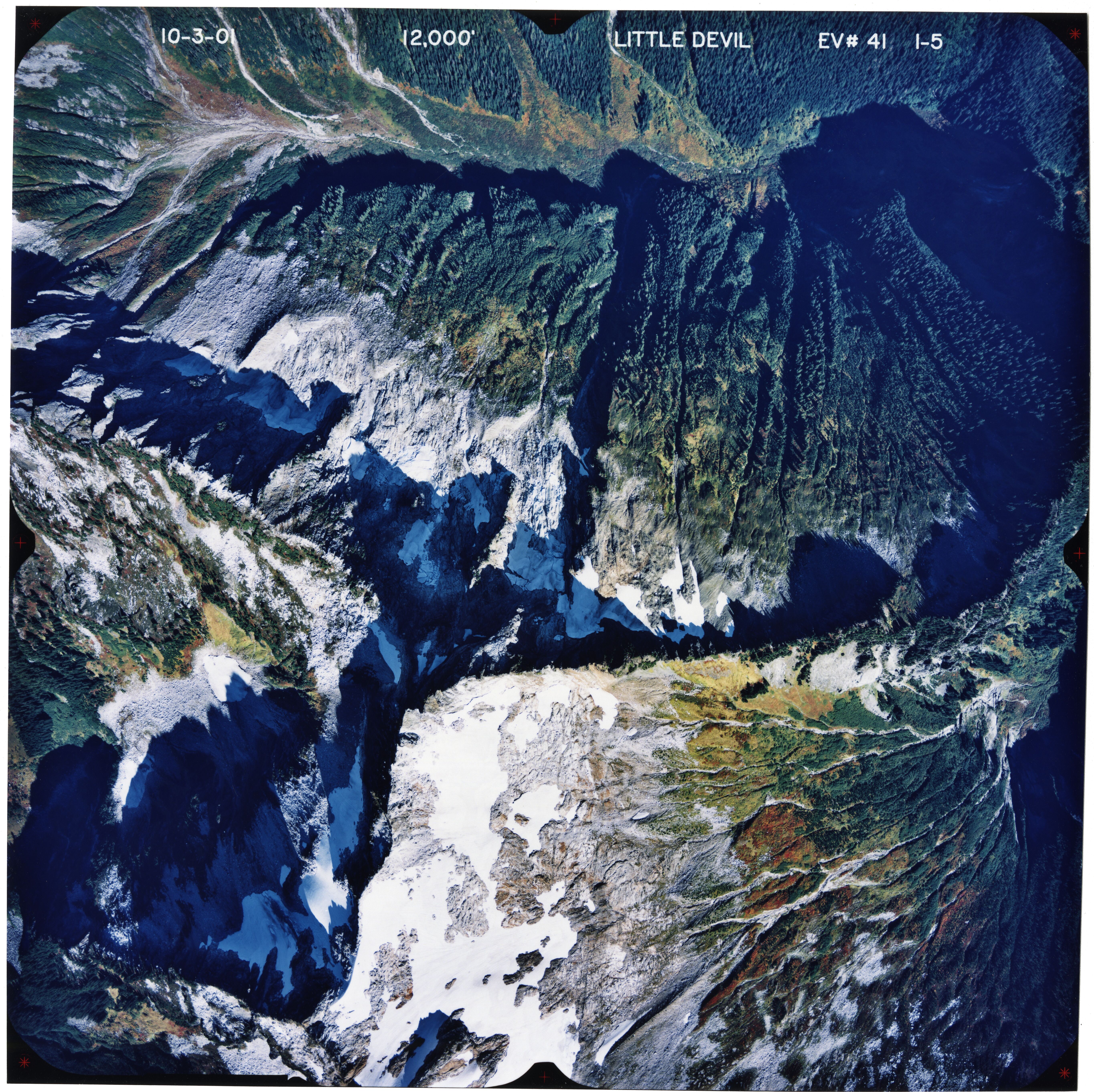
Little Devil Peak, 2001, 1-5
Color aerial photograph of glaciated mountain peak with forested valleys below.
Aerial photograph of glaciation on Little Devil Peak, 2001
U.S. National Park Service
This digital asset is in the public domain. When using this asset for any purpose, including online, credit: 'Courtesy of North Cascades NPS Complex Museum Collection, Aerial Photograph Collection.'
Public domain
Little Devil Peak, (Glacier)
Image
North Cascades National Park, Code: NOCA
Little Devil Peak
North Cascades National Park, Washington
Latitude: 48.8278884887695, Longitude: -121.35050201416
North Cascades National Park, Washington
Latitude: 48.8278884887695, Longitude: -121.35050201416
ICMS Archives Module : NOCA.0009.04.05.006
20191129
10/03/2001
Aerial photograph
Marblemount Curation Facility
Public Can View
Person: NOCA Curator
Organization: North Cascades NPS Complex
Position: Museum Curator
Address: 7280 Ranger Station Road, Marblemount, WA 98267
Email: NOCA_Curator@nps.gov.
Organization: North Cascades NPS Complex
Position: Museum Curator
Address: 7280 Ranger Station Road, Marblemount, WA 98267
Email: NOCA_Curator@nps.gov.
Thursday, September 10, 2020 4:52:27 PM
Thursday, September 10, 2020 4:52:27 PM
0009.04.05.006_LittleDevil_2001_1-5.tif
tif
178.4 MB
Monitoring