Select Item below to DOWNLOAD - Once item is selected, right click and choose 'save as'
63ad7a85-68cd-49e0-bd66-304be621796b
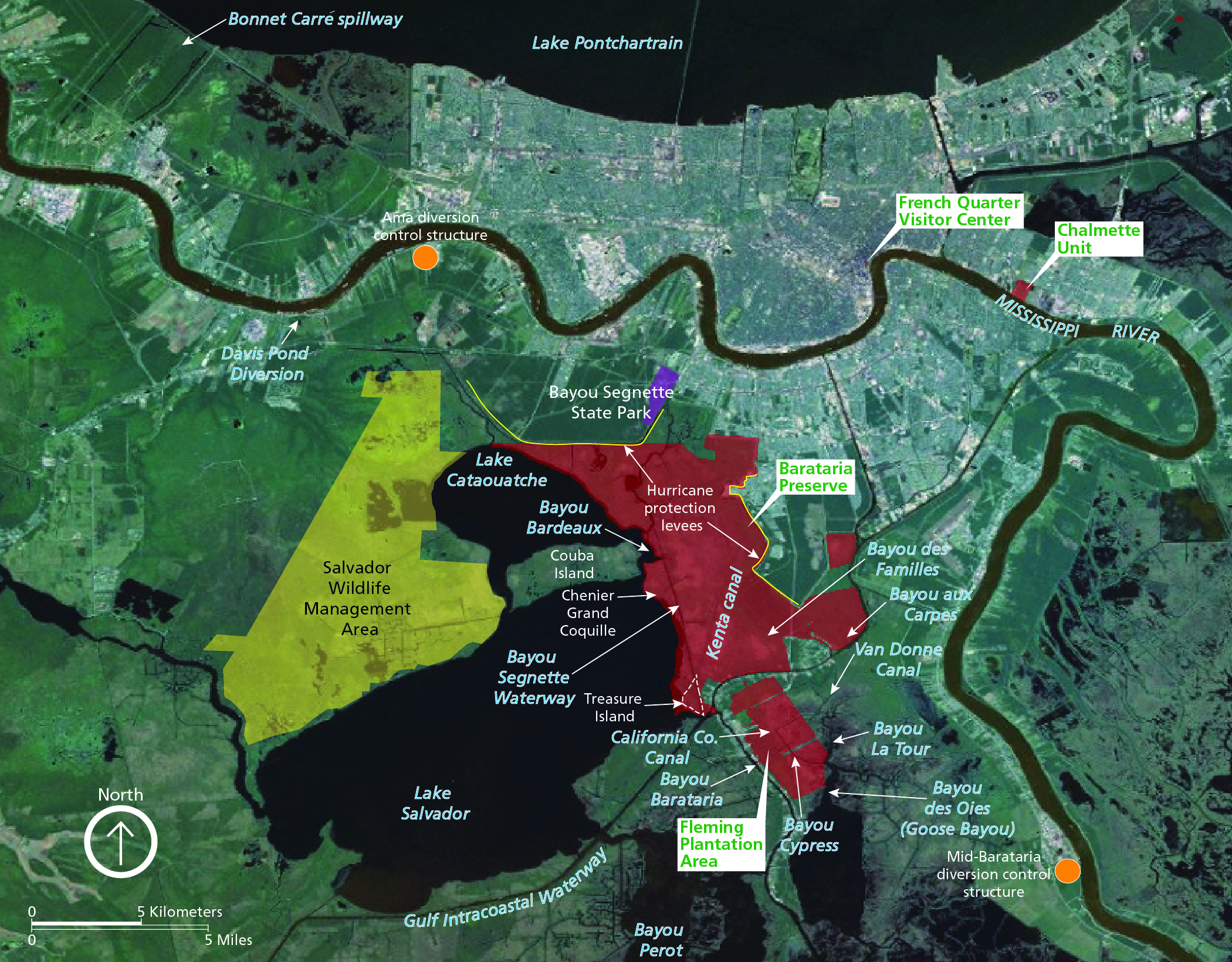
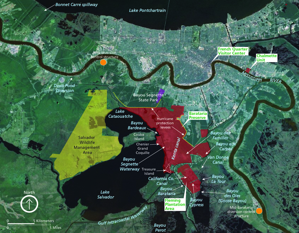
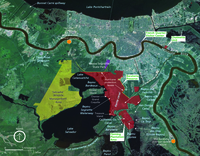
Location map for Barataria Preserve and vicinity.
Location map for Barataria Preserve and vicinity. Significant features are shown including French Quarter Visitor Center, Chalmette Unit, Fleming Plantation Area, Salvador Wildlife Management Area, Hurricane protection levees, Ama diversion control structure, Mid-Barataria diversion control structure, canals, and bodies of water.
Significant features, both natural and artificial, are marked on the map. Red shading highlights NPS areas such as Barataria Preserve and the Chalmette Unit. Orange dots mark the Ama and Mid-Barataria sediment diversions structures; these features are planned and not currently present on the landscape.
Permission must be secured from the individual copyright owners to reproduce any copyrighted materials contained within this website. Digital assets without any copyright restrictions are public domain.
Graphic by Trista Thornberry-Ehrlich (Colorado State University).
Public domain:Full Granting Rights
Image
Jean Lafitte National Historical Park and Preserve, Code: JELA
Jean Lafitte National Historical Park and Preserve, Louisiana
Latitude: 29.8020095825195, Longitude: -90.1701812744141
Latitude: 29.8020095825195, Longitude: -90.1701812744141
01/01/0001
Public Can View
Monday, June 14, 2021 4:52:50 PM
Monday, June 14, 2021 4:52:50 PM
2_JELA_BaratariaPreserveMap_0410-2019_tte-01.jpg
Monday, January 1, 0001 12:00:00 AM
jpg
7.3 MB
Scenic