Select Item below to DOWNLOAD - Once item is selected, right click and choose 'save as'
619812cc-b4e2-462d-9e06-26da3d0534c2
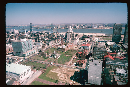
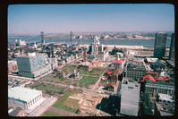
Independence National Historical Park. Aerial. Looking east between Chestnut & Walnut Streets, past 4th St., towards Delaware River.
Independence National Historical Park. Aerial. Looking east between Chestnut & Walnut Streets, past 4th St., towards Delaware River.
Independence National Historical Park. Aerial. Looking east between Chestnut & Walnut Streets, past 4th St., towards Delaware River.
National Park Service
"7" and "APR 75 W4" black stamps. INDE NHP and NPS Photo Frear stamps. Kodak Kodachrome Transparency slide.
This digital asset is in the public domain. When using this asset for any purpose, including online, credit: 'Courtesy National Park Service'
Richard Frear, WASO
Public domain
Image
Independence National Historical Park, Code: INDE
Independence National Historical Park, Philadelphia County, Pennsylvania
Latitude: 39.9454002380371, Longitude: -75.1468963623047
Latitude: 39.9454002380371, Longitude: -75.1468963623047
ICMS (Interior Collection Managment System) : INDE 104528
April 1975
Public Can View
Person: Archivist
Organization: US National Park Service
Position: Cultural Resource Management
Address: Independence National Historical Park, 143 South Third Street, Philadelphia PA 19106
Email: INDEVisitorinfo@nps.gov
Organization: US National Park Service
Position: Cultural Resource Management
Address: Independence National Historical Park, 143 South Third Street, Philadelphia PA 19106
Email: INDEVisitorinfo@nps.gov
Thursday, May 11, 2023 7:14:34 PM
Thursday, May 11, 2023 7:14:34 PM
CAT-104528_INDE-078.jpg
jpg
2.6 MB
Historic