Select Item below to DOWNLOAD - Once item is selected, right click and choose 'save as'
608b7070-e4a1-4b02-869b-0190fdb44ffd
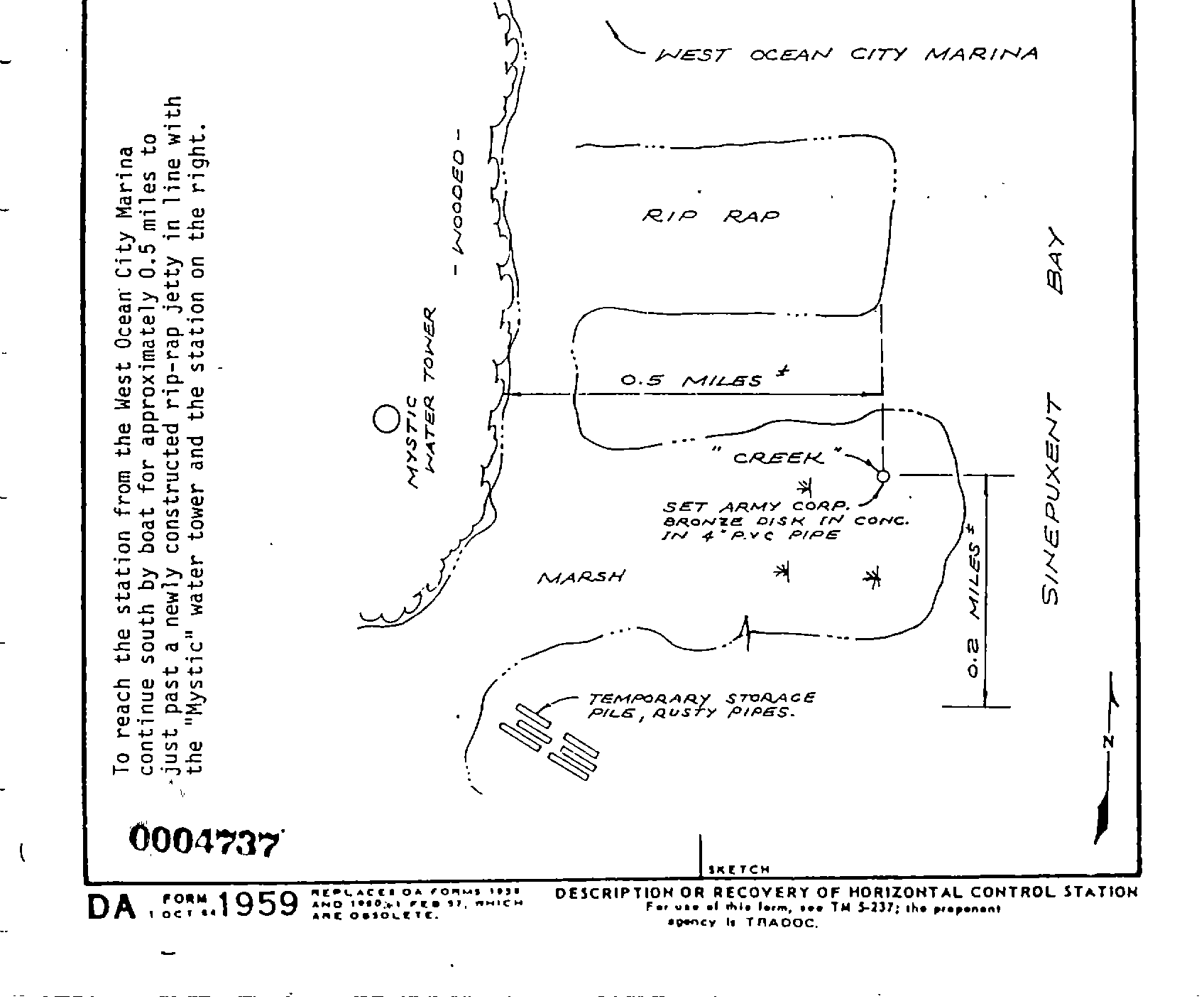
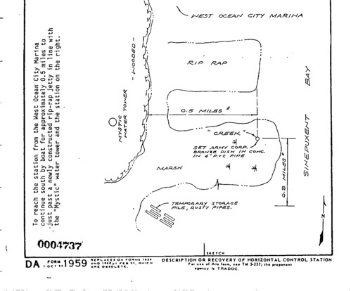
ASIS CREEK ASIS 00004737 gif
ASIS CREEK ASIS 00004737 gif
Survey monument record sheet, Sketch number: 00004737
U. S. National Park Service
This digital asset is in the public domain. When using this asset for any purpose, including online, credit: 'U.S. National Park Service, Land Resources Division'.
Public domain
Image
Assateague Island National Seashore, Code: ASIS
Assateague Island National Seashore
Latitude: 38.0390281677246, Longitude: -75.2496337890625
Latitude: 38.0390281677246, Longitude: -75.2496337890625
MONUMENTID for Monuments : ASIS CREEK
2024/11/15
01/01/1977
NGS
Public Can View
Organization: Land Resources Division
Position: Program Coordinator
Address: 1849 C Street, NW, Suite 2340, Main Interior Building, Washington, DC 20240
Position: Program Coordinator
Address: 1849 C Street, NW, Suite 2340, Main Interior Building, Washington, DC 20240
Thursday, December 5, 2024 6:59:02 PM
Thursday, December 5, 2024 6:59:02 PM
ASIS_00004737.gif
gif
36.6 kB
Monitoring
,
Inventory
,
Map