Select Item below to DOWNLOAD - Once item is selected, right click and choose 'save as'
5C9FBF71-BFDA-7EF7-12D10D65D6D67876
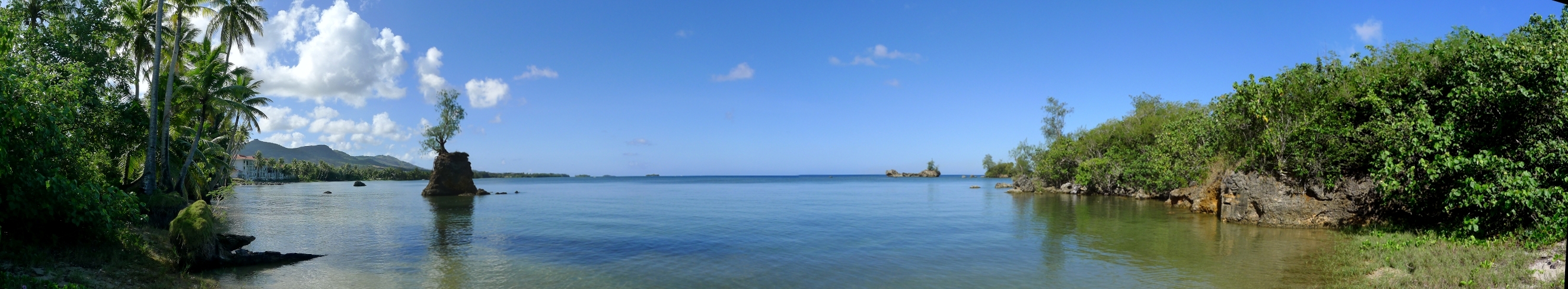
Apaca Point Panorama
Apaca Point Panorama at Asan and Agat Invasion Beaches
Agat Unit - Asan and Agat Invasion Beaches, War in the Pacific National Historical Park. Apaca Point was one of the outcrops where carefully-concealed Japanese defense structures were mistaken for vegetation-covered dunes during the World War II assault on the island in 1944.
U.S. National Park Service
Permission must be secured from the individual copyright owners to reproduce any copyrighted materials contained within this website. Digital assets without any copyright restrictions are public domain.
NPS Park Cultural Landscapes Program
Public domain:Full Granting Rights
Image
War in the Pacific National Historical Park, Code: WAPA
Park Cultural Landscapes Program, Code: PCLP
Park Cultural Landscapes Program, Code: PCLP
Latitude: 13.40234, Longitude: 144.66336
War in the Pacific National Historical Park, Guam , Guam
Latitude: 13.3905000686646, Longitude: 144.654006958008
War in the Pacific National Historical Park, Guam , Guam
Latitude: 13.3905000686646, Longitude: 144.654006958008
3/9/2012 10:47:00 AM
Public Can View
Wednesday, September 12, 2018 4:10:20 PM
Wednesday, September 12, 2018 4:10:20 PM
5CA09E97-D910-071D-5E122BCD9CA2A8D5.jpg
Friday, March 9, 2012 11:21:59 PM
jpg
1.0 MB
Scenic