Select Item below to DOWNLOAD - Once item is selected, right click and choose 'save as'
5bf429416fcb4207b9a5a30c8b92e5c9
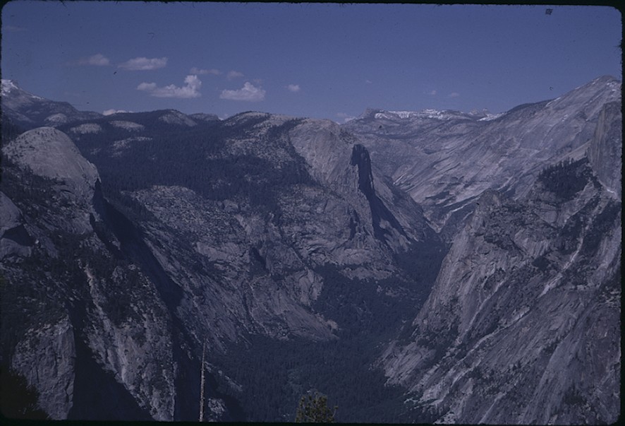
Tenaya Canyon from Glacier Point
Tenaya Canyon from Glacier Point
A-5-136, Tenaya Canyon from Glacier Point, W. Hochstetler, 1968
Slide Number: A-05-136
U. S. National Park Service
Permission must be secured from the individual copyright owners to reproduce any copyrighted materials contained within this website.
Public domain
Image
Yosemite National Park, Code: YOSE
Tenaya Canyon from Glacier Point
Yosemite National Park, California
Latitude: 37.8399200439453, Longitude: -119.540397644043
Yosemite National Park, California
Latitude: 37.8399200439453, Longitude: -119.540397644043
2011/11/30
01/01/1968 - 12/30/1968
Public Can View
Person: Archivist
Organization: US National Park Service
Address: Yosemite National Park Archives, PO Box 700-W, El Portal, CA 95318
Email: yose_archives@nps.gov
Organization: US National Park Service
Address: Yosemite National Park Archives, PO Box 700-W, El Portal, CA 95318
Email: yose_archives@nps.gov
Friday, May 31, 2019 10:58:21 AM
Friday, May 31, 2019 10:58:21 AM
A-05-136.jpg
jpg
130.2 kB
Historic