Select Item below to DOWNLOAD - Once item is selected, right click and choose 'save as'
5aff799b-cf95-4fbb-82e0-dfd9b4573333
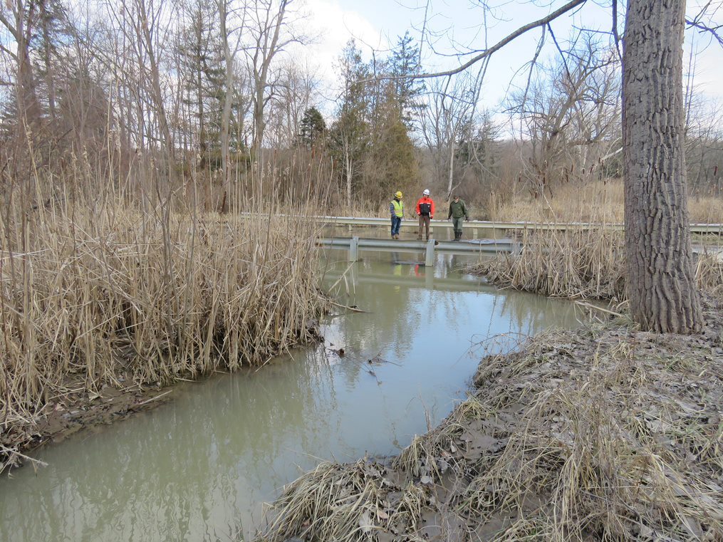
Stanford Road Flooding, View East - 2
The water is still and cloudy. The stream’s reed-covered banks are coated in wet mud.
This upstream view looks east across Stanford Road, hidden by floodwater. Project leaders stand between two guardrails. The large tree on the right serves as a landmark in the “after” photos.
Permission must be secured from the individual copyright owners to reproduce any copyrighted materials contained within this website. Digital assets without any copyright restrictions are public domain.
The water is still and cloudy. The stream’s reed-covered banks are coated in wet mud.
Public domain:Full Granting Rights
Image
Cuyahoga Valley National Park, Code: CUVA
Cuyahoga Valley National Park, Ohio
Latitude: 41.1502799987793, Longitude: -81.5678787231445
Latitude: 41.1502799987793, Longitude: -81.5678787231445
02/15/2019
01/01/0001
Public Can View
Friday, October 2, 2020 1:13:33 PM
Friday, October 2, 2020 1:13:33 PM
SR4.jpg
Monday, January 1, 0001 12:00:00 AM
jpg
252.1 kB
Scenic