Select Item below to DOWNLOAD - Once item is selected, right click and choose 'save as'
5a8f68bc-9577-43e1-93d7-d6aee14c1de3
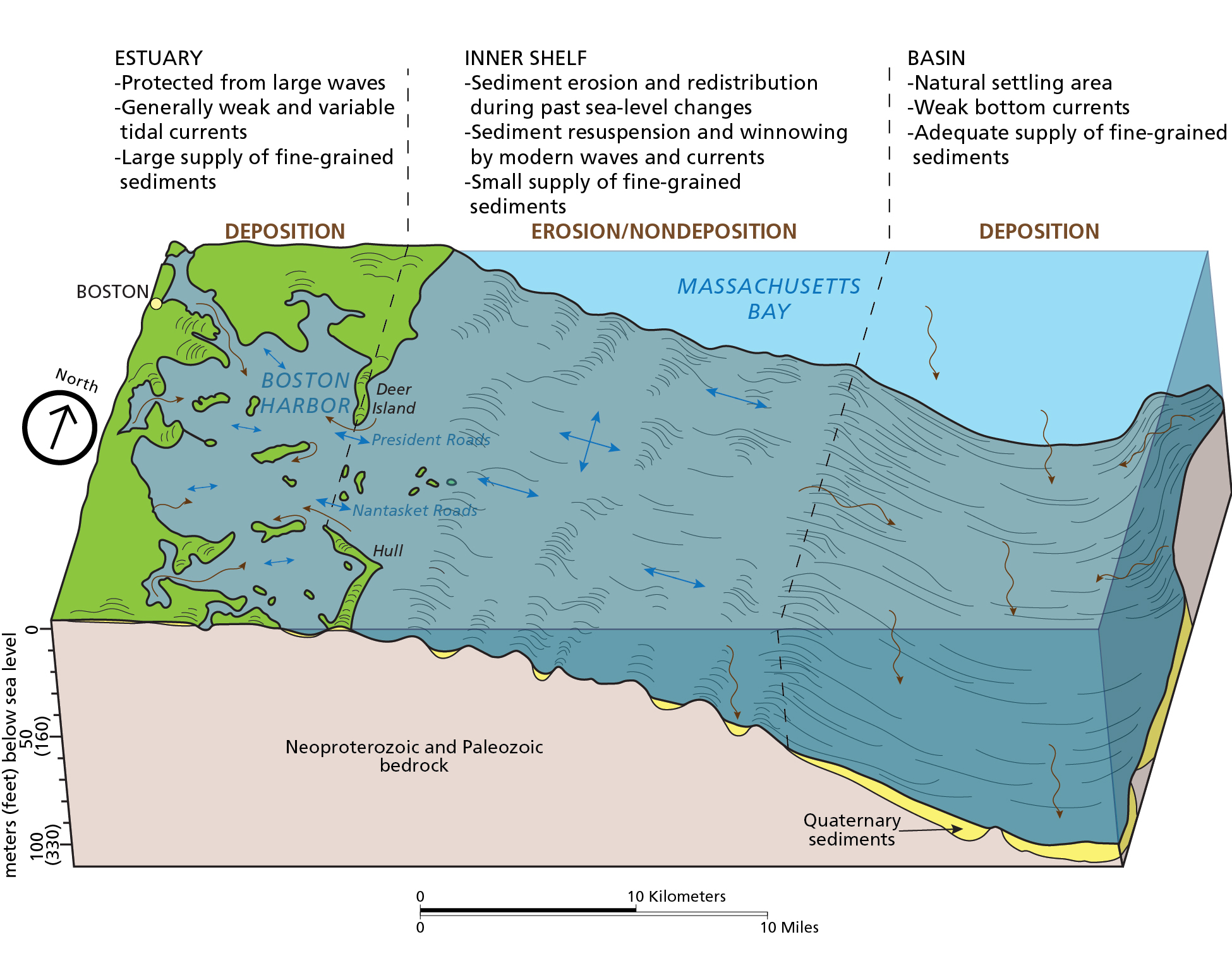
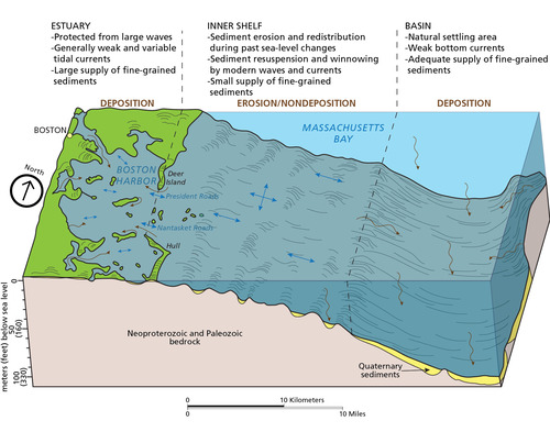
Sedimentary Environments
Diagram of sedimentary environments in Boston Harbor and Massachusetts Bay. The graphic shows (from shore to open ocean, estuary areas of deposition, inner shelf areas of erosion and nondeposition, and the ocean basin area of deposition.
Diagram of sedimentary environments in Boston Harbor and Massachusetts Bay. In contrast to the erosional
regime of the islands themselves, the subaqueous area around Boston Harbor Islands is largely depositional in nature.
Fine-grained sediments come from mainland fluvial sources, some tidal currents, and a small amount from the islands
themselves. Blue arrows indicate tides and wave directions, brown arrows indicate sediment sources.
Permission must be secured from the individual copyright owners to reproduce any copyrighted materials contained within this website. Digital assets without any copyright restrictions are public domain.
Graphic by Trista
Thornberry-Ehrlich (Colorado State University) after figure 12 in Knebel and Circé (1995)
Public domain:Full Granting Rights
Image
Boston Harbor Islands National Recreation Area, Code: BOHA
Boston Harbor Islands National Recreation Area, Massachusetts
Latitude: 42.2621994018555, Longitude: -70.8761825561523
Latitude: 42.2621994018555, Longitude: -70.8761825561523
01/01/0001
Public Can View
Monday, August 16, 2021 4:25:17 PM
Monday, August 16, 2021 5:17:18 PM
07_BOHA_bottomSedEnvironments_KnebelandCirce1995_0428-2015_tte-01.jpg
Monday, January 1, 0001 12:00:00 AM
jpg
919.6 kB
Scenic