Select Item below to DOWNLOAD - Once item is selected, right click and choose 'save as'
5982A3AE-D1C0-9E06-706C2548F29EC743
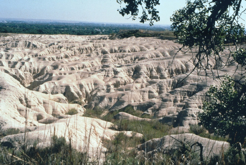
Scotts Bluff NM Badlands
Scotts Bluff badlands
These impassible clay formations between the bluff and the North Platte River pushed the emigrants on the Oregon and California Trails south.
U.S. National Park Service
Permission must be secured from the individual copyright owners to reproduce any copyrighted materials contained within this website. Digital assets without any copyright restrictions are public domain.
NPS
Public domain:Full Granting Rights
Image
Scotts Bluff National Monument, Code: SCBL
Scotts Bluff National Monument
Latitude: 41.49349, Longitude: -103.396
Latitude: 41.49349, Longitude: -103.396
Public Can View
Wednesday, January 3, 2018 8:29:54 AM
Wednesday, January 3, 2018 8:29:54 AM
598B2914-E6DB-2BBC-88E325F6E33CE1F1.jpg
Thursday, February 3, 2011 10:37:48 PM
jpg
973.5 kB
Scenic