Select Item below to DOWNLOAD - Once item is selected, right click and choose 'save as'
594f5345-524f-434b-2022-020241202011
Castle Cliffs rock fall
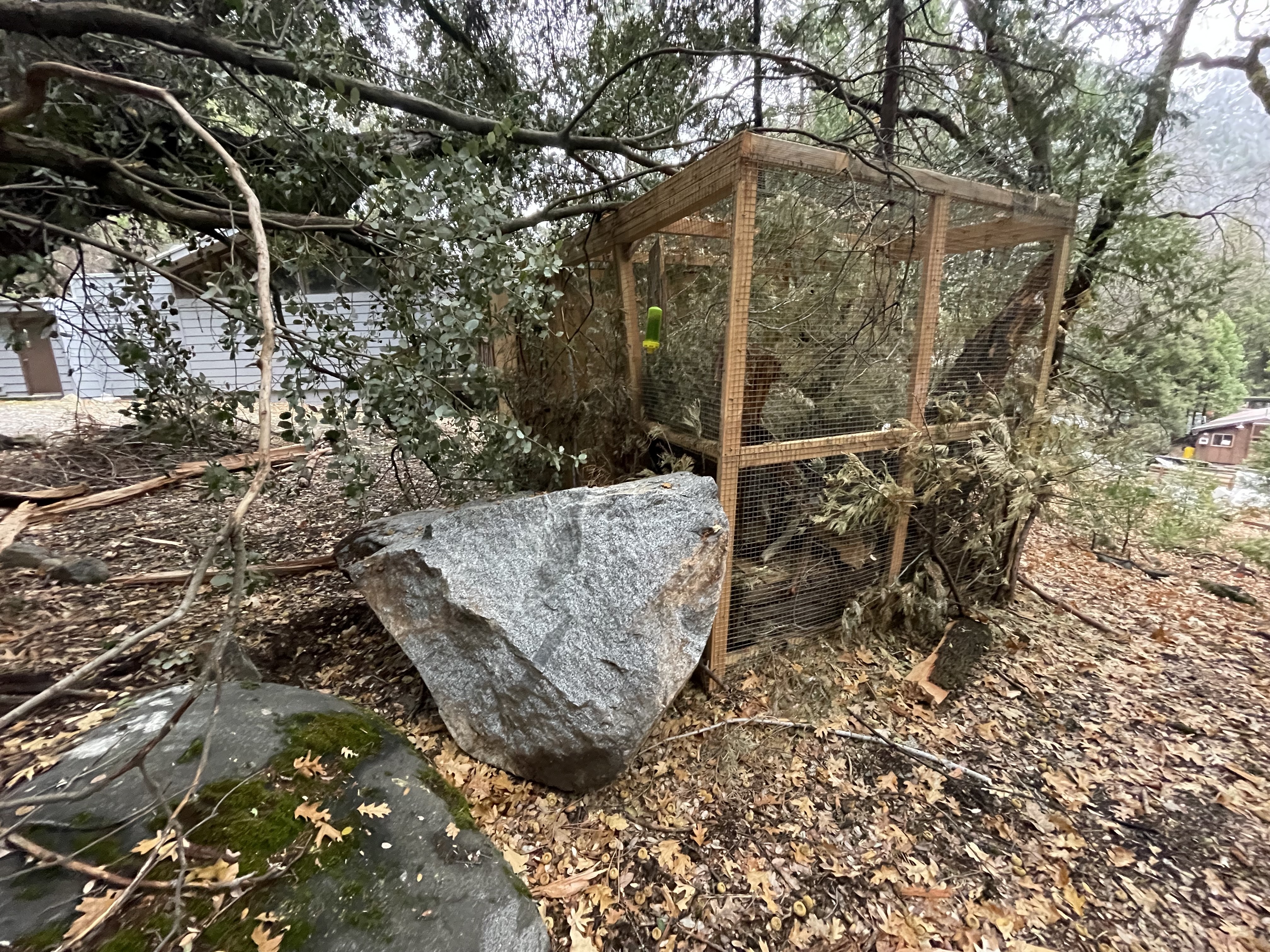
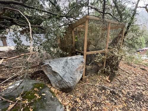
A rock fall from the slope below Castle Cliffs caused boulders to tumble onto the Valley Loop Trail, with some landing at the bottom of the hill. The largest boulder, approximately 3 m3 in volume, came to rest against a wood and wire enclosure built in the summer of 2024 to temporarily house an abandoned fisher kit. The fisher had been returned to the wild by the time of the rock fall, so the enclosure was empty and only sustained minor damage on its north side. The boulder, as well as a few smaller rocks, came to rest within 15 meters of the Courthouse.
UTM East: 272064; UTM North: 4181520; Elevation: 1358
U.S. National Park Service
To the best of our knowledge we believe this image to be copyright free and in the public domain. When using this asset for any purpose, including online, credit: 'Courtesy U.S. National Parks'
NPS Photographer
Public domain
image
Yosemite National Park, Code: YOSE
Indian Canyon
Latitude: 37.7526165780704, Longitude: -119.587270968621
Castle Cliffs
Yosemite National Park, California
Latitude: 37.8399200439453, Longitude: -119.540397644043
Latitude: 37.7526165780704, Longitude: -119.587270968621
Castle Cliffs
Yosemite National Park, California
Latitude: 37.8399200439453, Longitude: -119.540397644043
2024/12/02
12/02/2024
Public Can View
Person: Greg Stock
Organization: Yosemite NP
Position: Park Geologist
Address: El Portal, CA 95318
Email: greg_stock@nps.gov
Organization: Yosemite NP
Position: Park Geologist
Address: El Portal, CA 95318
Email: greg_stock@nps.gov
Tuesday, February 25, 2025 6:34:06 PM
Tuesday, February 25, 2025 6:34:06 PM
2024120201_1_NPS.JPG
jpg
5.5 MB
Events