Select Item below to DOWNLOAD - Once item is selected, right click and choose 'save as'
594f5345-524f-434b-2022-020230314102
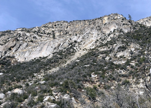
Merced River Gorge rock fall
A rock fall scar (upper right; rightmost peak in the mid ground) and runout path on a steep hillslope.
UTM East: 256945; UTM North: 4174381; Elevation: 1073
U.S. National Park Service
To the best of our knowledge we believe this image to be copyright free and in the public domain. When using this asset for any purpose, including online, credit: 'Courtesy U.S. National Parks'
NPS Photographer
Public domain
image
Yosemite National Park, Code: YOSE
Merced River Gorge
Latitude: 37.68445996, Longitude: -119.75631388
El Portal Road
Parkline
Yosemite National Park, California
Latitude: 37.8399200439453, Longitude: -119.540397644043
Latitude: 37.68445996, Longitude: -119.75631388
El Portal Road
Parkline
Yosemite National Park, California
Latitude: 37.8399200439453, Longitude: -119.540397644043
2023/03/16
03/14/2023
Public Can View
Person: Greg Stock
Organization: Yosemite NP
Position: Park Geologist
Address: El Portal, CA 95318
Email: greg_stock@nps.gov
Organization: Yosemite NP
Position: Park Geologist
Address: El Portal, CA 95318
Email: greg_stock@nps.gov
Thursday, February 15, 2024 8:52:53 PM
Thursday, February 15, 2024 8:52:53 PM
2023031410_2_NPS.JPG
jpg
7.1 MB
Events