Select Item below to DOWNLOAD - Once item is selected, right click and choose 'save as'
594f5345524f434b2022020170109021
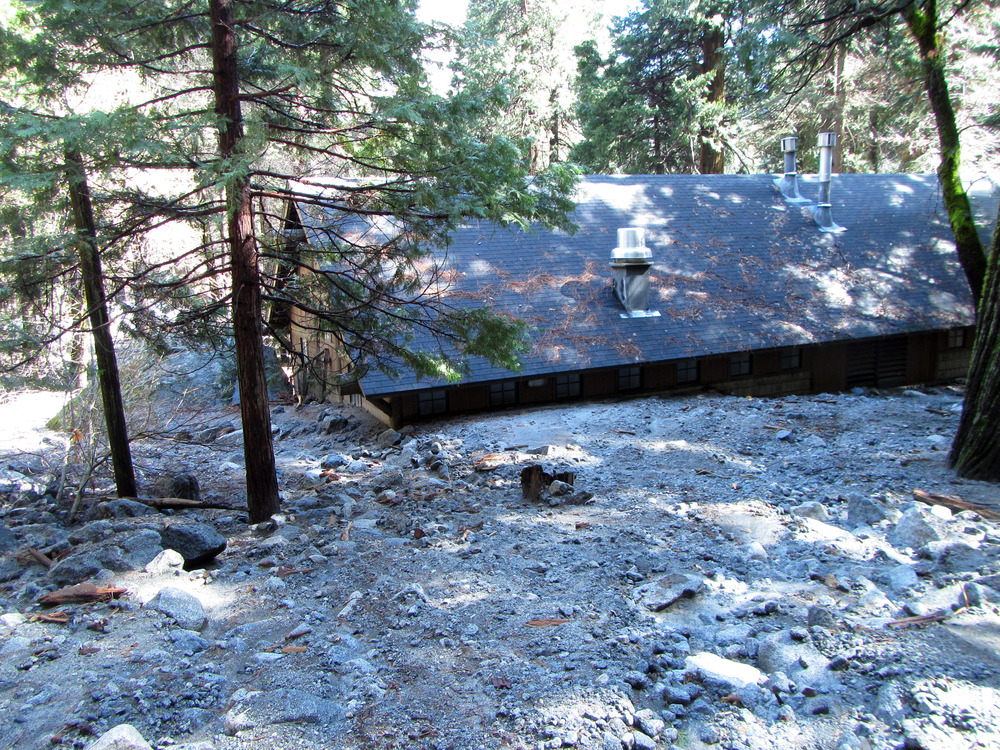
2017 Ledge Trail debris flow
The uphill side of a building buried to its eaves with sand, gravel, and cobbles.
A debris flow occurred from beneath the ledge along which the "Ledge Trail" traverses. Much of the debris entrained in the flow originated from prexisting rock fall debris on the ledge. As the debris flow reached the Valley floor behind the now closed shower house it fanned out, burying the uphill side of the shower house in sand, gravel, and cobbles more than 1 m deep. Sand and gravel extended all the way out to the Curry Village Amphitheater.
UTM East: 273324; UTM North: 4179700; Elevation: 1223
U.S. National Park Service
To the best of our knowledge we believe this image to be copyright free and in the public domain. When using this asset for any purpose, including online, credit: 'Courtesy U.S. National Parks'
NPS Photographer
Public domain
image
Yosemite National Park, Code: YOSE
Glacier Point
Latitude: 37.7365419757352, Longitude: -119.57241452
Ledge Trail
Yosemite National Park, California
Latitude: 37.8399200439453, Longitude: -119.540397644043
Latitude: 37.7365419757352, Longitude: -119.57241452
Ledge Trail
Yosemite National Park, California
Latitude: 37.8399200439453, Longitude: -119.540397644043
20170327
01/09/2017
Public Can View
Organization: Yosemite NP
Position: Park Geologist
Address: El Portal, CA 95318
Email: greg_stock@nps.gov
Position: Park Geologist
Address: El Portal, CA 95318
Email: greg_stock@nps.gov
Wednesday, May 11, 2022 11:48:35 PM
Tuesday, August 9, 2022 5:45:51 PM
2017010902_1_NPS.jpg
jpg
8.8 MB
Events