Select Item below to DOWNLOAD - Once item is selected, right click and choose 'save as'
594f5345524f434b2022020150721022
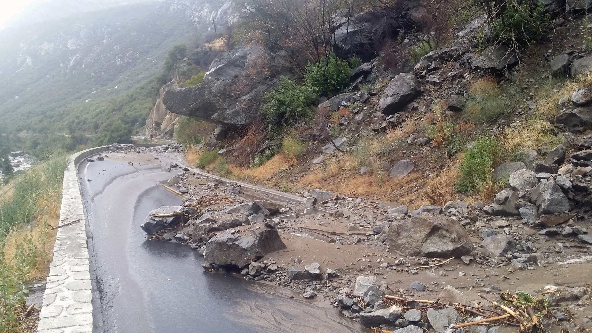
2015 Dog Rock debris flow
Fresh boulders, gravel, broken branches, and mud completely bury both lanes of a road.
A very intense thunderstorm at the western park boundary generated large debris flows within areas burned by the Dog Rock and El Portal fires. The largest debris of this storm occured from the colluvial slope above El Portal Road and below Parkline Slab between Windy Point and Parkline, within the area burned by the Dog Rock fire. Both lanes of El Portal Road were completely covered by rocks exceeding 1 meter in diameter, and at the thickest point the debris overtopped the approximately 1 meter tall rock wall lining the eastbound lane.
UTM East: 257711; UTM North: 4173584; Elevation: 737
U.S. National Park Service
Restrictions apply on use and/or reproduction (Copyrighted material): This Item is protected by copyright and/or related rights. Copyright: Delisle, Dan
Dan Delisle
Restrictions apply on use and/or reproduction:Copyright Unknown
image
Yosemite National Park, Code: YOSE
Merced River Gorge
Latitude: 37.6774815570045, Longitude: -119.74738139
El Portal Road
Yosemite National Park, California
Latitude: 37.8399200439453, Longitude: -119.540397644043
Latitude: 37.6774815570045, Longitude: -119.74738139
El Portal Road
Yosemite National Park, California
Latitude: 37.8399200439453, Longitude: -119.540397644043
20150721
07/21/2015
Public Can View
Organization: Yosemite NP
Position: Park Geologist
Address: El Portal, CA 95318
Email: greg_stock@nps.gov
Position: Park Geologist
Address: El Portal, CA 95318
Email: greg_stock@nps.gov
Wednesday, May 11, 2022 11:50:40 PM
Tuesday, August 9, 2022 5:38:31 PM
2015072102_2_Dan_Delisle.jpg
jpg
3.5 MB
Events