Select Item below to DOWNLOAD - Once item is selected, right click and choose 'save as'
594f5345524f434b2022020130611011
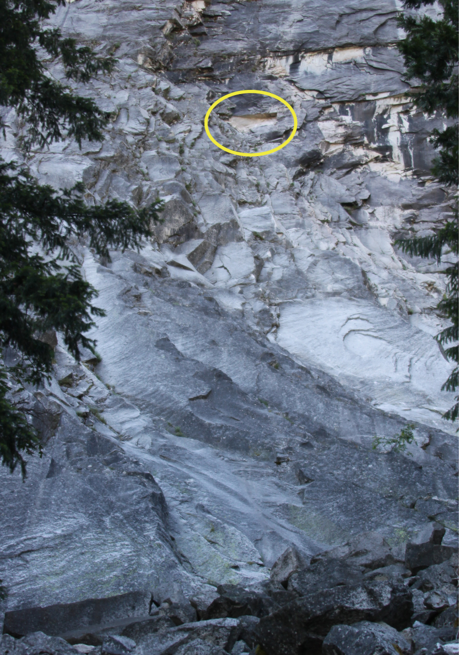
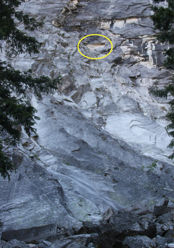
2013 Panorama Cliff rock fall
An annotated photo of steep rock cliff indicating the rock fall source area location with a yellow circle.
A rock fall from the Panorama Cliff. At least one boulder landed on the trail at the western edge of the uppermost switchback, but most debris fell west of the trail. There was a small dust cloud.
UTM East: 275308; UTM North: 4178026; Elevation: 1616
U.S. National Park Service
To the best of our knowledge we believe this image to be copyright free and in the public domain. When using this asset for any purpose, including online, credit: 'Courtesy U.S. National Parks'
NPS Photographer
Public domain
image
Yosemite National Park, Code: YOSE
Panorama Cliff
Latitude: 37.7219577351351, Longitude: -119.54940268
Yosemite National Park, California
Latitude: 37.8399200439453, Longitude: -119.540397644043
Latitude: 37.7219577351351, Longitude: -119.54940268
Yosemite National Park, California
Latitude: 37.8399200439453, Longitude: -119.540397644043
20130612
06/11/2013
Public Can View
Organization: Yosemite NP
Position: Park Geologist
Address: El Portal, CA 95318
Email: greg_stock@nps.gov
Position: Park Geologist
Address: El Portal, CA 95318
Email: greg_stock@nps.gov
Wednesday, May 11, 2022 11:54:53 PM
Thursday, July 28, 2022 8:30:52 PM
2013061101_1_NPS.jpg
jpg
1.1 MB
Events