Select Item below to DOWNLOAD - Once item is selected, right click and choose 'save as'
594f5345524f434b2022020050701011
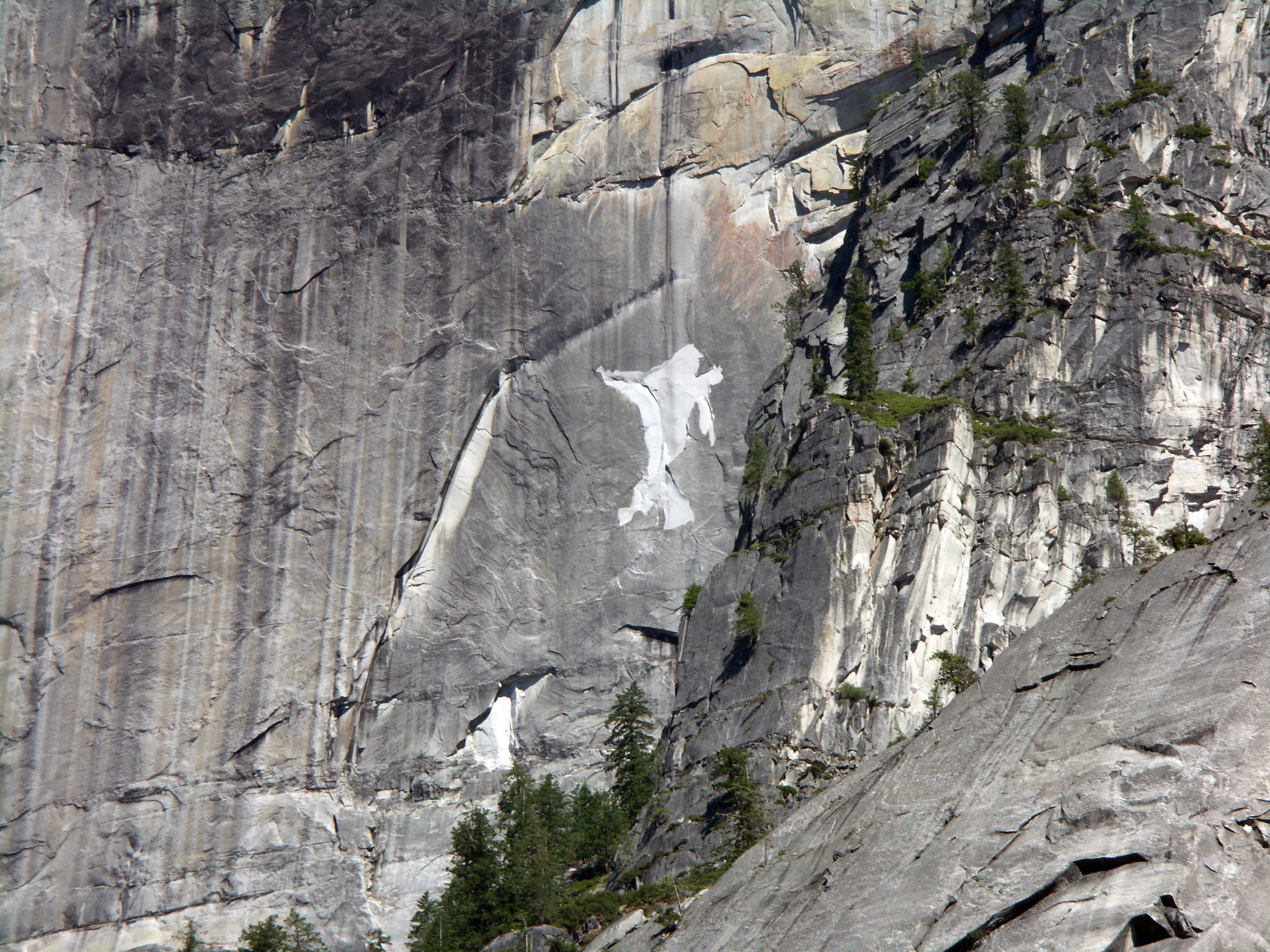
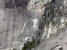
2005 Half Dome rock fall
A close perspective of light colored rock fall source area on cliff.
A rock fall occurred from the northwest face of Half Dome. The failed slab was a relatively thin (roughly 1 m thick) flake that was bounded on the east and west by areas that had failed in 2003, and bounded on the top and bottom by obvious cracks, suggesting that the flake was mostly detached along a sheeting joint prior to failure.
UTM East: 276558; UTM North: 4180476; Elevation: 2192
U.S. National Park Service
To the best of our knowledge we believe this image to be copyright free and in the public domain. When using this asset for any purpose, including online, credit: 'Courtesy U.S. National Parks'
NPS Photographer
Public domain
image
Yosemite National Park, Code: YOSE
Half Dome
Latitude: 37.7443244346305, Longitude: -119.5359855
Yosemite National Park, California
Latitude: 37.8399200439453, Longitude: -119.540397644043
Latitude: 37.7443244346305, Longitude: -119.5359855
Yosemite National Park, California
Latitude: 37.8399200439453, Longitude: -119.540397644043
20050701
07/01/2005
Public Can View
Organization: Yosemite NP
Position: Park Geologist
Address: El Portal, CA 95318
Email: greg_stock@nps.gov
Position: Park Geologist
Address: El Portal, CA 95318
Email: greg_stock@nps.gov
Thursday, May 12, 2022 12:03:27 AM
Thursday, July 28, 2022 6:28:33 PM
2005070101_1_NPS.jpg
jpg
6.4 MB
Events