Select Item below to DOWNLOAD - Once item is selected, right click and choose 'save as'
594f5345524f434b2022019960710012
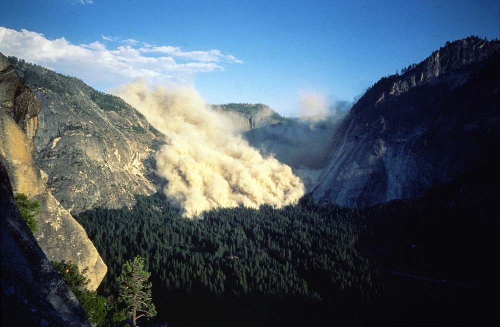
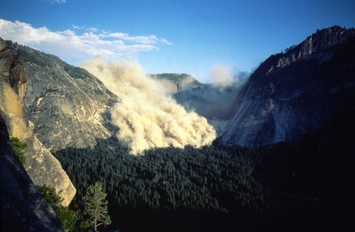
1996 Happy Isles rock fall | slide
A gray dust cloud rises above the tree covered valley floor and fills the end of the valley. Steep rock cliffs rise above the valley floor on both sides.
A rock slide from an arch-like cliff between Washburn and Glacier Point resulted in an air blast and a rapidly moving dust cloud that enveloped the area of the Nature Center and Happy Isles in a thick cloud of dust that for several minutes blocked out the early evening sunlight. The impacts of the large rock masses onto the talus slope generated an air blast that traveled well beyond the limit of fresh rock on the talus slope and knocked down or snapped 1000 trees.
UTM East: 273711; UTM North: 4178743; Elevation: 1955
U.S. National Park Service
Restrictions apply on use and/or reproduction (Copyrighted material): This Item is protected by copyright and/or related rights. Copyright: Walter, David
David Walter
Public domain:Restrictions may apply on use and/or reproduction
image
Yosemite National Park, Code: YOSE
Glacier Point
Latitude: 37.7280206569604, Longitude: -119.56772896
Happy Isles
Yosemite National Park, California
Latitude: 37.8399200439453, Longitude: -119.540397644043
Latitude: 37.7280206569604, Longitude: -119.56772896
Happy Isles
Yosemite National Park, California
Latitude: 37.8399200439453, Longitude: -119.540397644043
19960710
07/10/1996
Public Can View
Organization: Yosemite NP
Position: Park Geologist
Address: El Portal, CA 95318
Email: greg_stock@nps.gov
Position: Park Geologist
Address: El Portal, CA 95318
Email: greg_stock@nps.gov
Thursday, May 12, 2022 12:04:02 AM
Thursday, July 28, 2022 4:53:49 PM
1996071001_2_David_Walter.jpg
jpg
564.1 kB
Events