Select Item below to DOWNLOAD - Once item is selected, right click and choose 'save as'
58835363-4e60-4609-ac61-289ebfc817b4
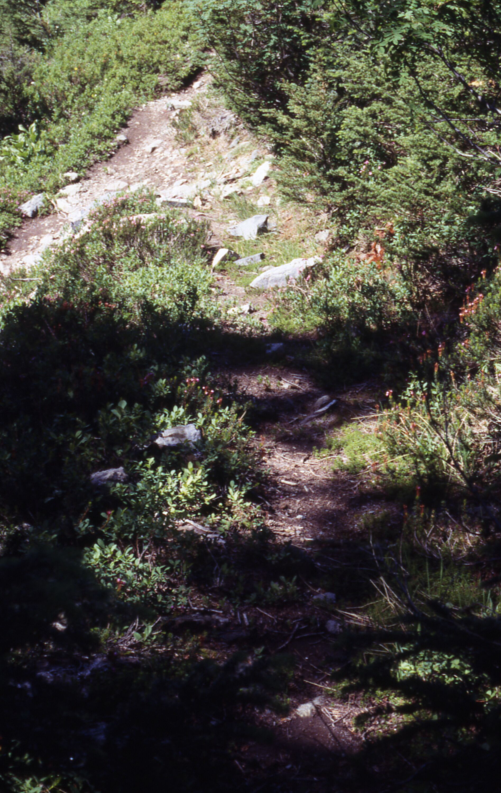
Trail to Pelton Hiker Trail from Cascade Pass and diverging social trail, 9/6/2002
A bare strip of land studded with rocks surrounded by trees, shrubs, and wildflowers.
Cascade Pass, Pelton Basin, revegetation monitoring photograph. Text on slide frame reads: "REV/CAS/PEL/b-13, Trail into Pelton Hiker, social trail, poorly revegetated, 9-6-02." An arrow on the upper left side of the frame points to the trail to Pelton Hiker, and an arrow at the middle bottom of the slide points to the social trail. A third arrow at the top middle side of the frame points towards the negative with no additional commentary. (North Cascades NPS Complex Museum Collection, NOCA.0013 Revegetation Program Records, Series XI: Photographs, File 001 - Cascade Pass Vicinity Impacts and Revegetation Sites, 1970-2004)
U.S. National Park Service
This digital asset is in the public domain. When using this asset for any purpose, including online, credit: 'Courtesy of North Cascades NPS Complex Museum Collection, Revegetation Program Records.'
NPS Photo
Public domain
Native Plant Restoration, (North Cascades Program)
, Cascade Pass, (North Cascades Locality)
, Revegetation, (North Cascades Activity)
, Cascade Pass, (North Cascades Locality)
, Revegetation, (North Cascades Activity)
Image
North Cascades National Park, Code: NOCA
North Cascades National Park, Washington
Latitude: 48.8278884887695, Longitude: -121.35050201416
Cascade Pass
Latitude: 48.8278884887695, Longitude: -121.35050201416
Cascade Pass
ICMS Archives Module : NOCA.0013.11.001
2024/02/13
09/06/2002
slide transparency
Curation Facility
Public Can View
Person: NOCA Curator
Organization: North Cascades NPS Complex
Position: Museum Curator
Address: 7280 Ranger Station Road, Marblemount, WA 98267
Email: NOCA_Curator@nps.gov.
Organization: North Cascades NPS Complex
Position: Museum Curator
Address: 7280 Ranger Station Road, Marblemount, WA 98267
Email: NOCA_Curator@nps.gov.
Thursday, January 30, 2025 4:14:28 PM
Thursday, January 30, 2025 4:14:28 PM
0013.11.001.0750.tif
tif
34.1 MB
Monitoring