Select Item below to DOWNLOAD - Once item is selected, right click and choose 'save as'
582de7bf348d4e09b91679a97cc3aec2
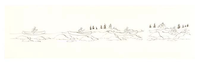
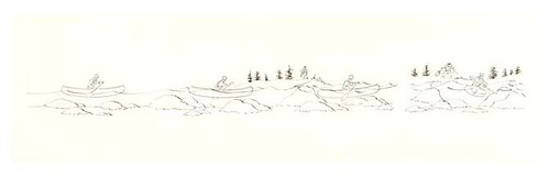
Four-spot illustration diagram showing Class I through Class IV navigational difficulty for whitewater.
Four-spot illustration diagram showing Class I through Class IV navigational difficulty for whitewater.
Abbr=WE
U.S. National Park Service
Art_Registration_No=WE-0074; Reflective Art
Government owns art and all reproduction rights.
Public domain
Recreation, (HFC ArtTheme)
Image
Big South Fork National River and Recreation Area, Code: BISO
Big South Fork National River and Recreation Area
Latitude: 36.3837394714355, Longitude: -84.6743087768555
Latitude: 36.3837394714355, Longitude: -84.6743087768555
Image Management System : IMS 03630
20190904
01/01/1990 - 12/30/1990
Count:1/14; Exhibit 3 / Graphic # 3-16
O 9
Public Can View
Organization: Harpers Ferry Center
Address: Harpers Ferry Center, 67 Mather Place, Harpers Ferry, WV, 25425, 304-535-5050
Address: Harpers Ferry Center, 67 Mather Place, Harpers Ferry, WV, 25425, 304-535-5050
Friday, October 4, 2019 2:34:27 PM
Friday, October 4, 2019 2:34:27 PM
03630.jpg
jpg
11.9 kB
Museum