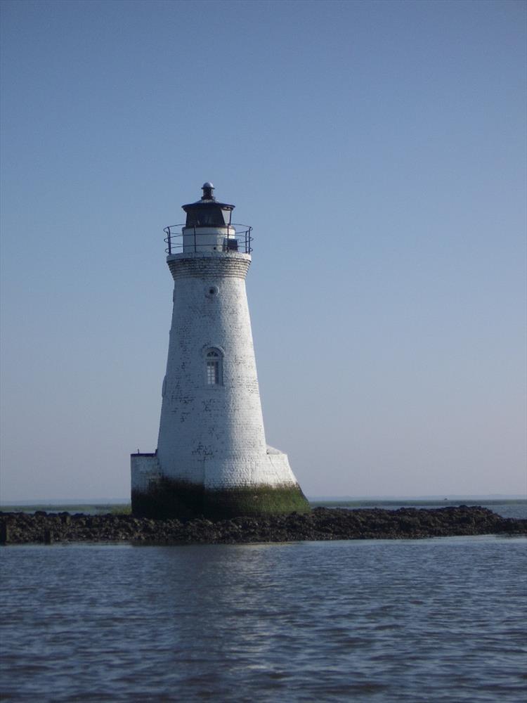
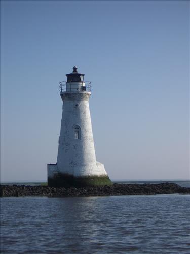
Cockspur Island Lighthouse during low-tide at Fort Pulaski National Monument in June 2007
Built in 1855, the Cockspur Island Lighthouse replaced an earlier structure at the same location. Although in the direct line of fire between the Confederate-held fort and United States artillery batteries, the lighthouse only sustained minor damage during the 30-hour seige in April 1862. Marking the entrance to the south channel of the Savannah River, the lighthouse was an active navigational beacon until 1909. It has been relit for historical purposes since March 18, 2007.
The lighthouse is open to the public, but only accessible by boat at low-tide. The islet is covered by oyster shells and marsh grass, but is usually submerged during high-tide. These pictures were taken between 8:00 a.m. and 9:00 a.m. EDT on 2007 June 22 (first full day of summer). According to NOAA (http://tidesandcurrents.noaa.gov/) low-tide was predicted to occur at 8:30 a.m. EDT with a height of 0.8 feet above Mean Lower Low Water.
The coordinates for the lighthouse are approximately 32° 1' 21"N, 80° 52' 49"W.
facing north, this is the low-tide condition, the darkened section at the base shows water level at high-tide
Permission must be secured from the individual copyright owners to reproduce any copyrighted materials contained within this website. Digital assets without any copyright restrictions are public domain.
Public domain:Note:Jerry Turner appears in image #5, although he is not recognizable. Mr. Turner is an NPS employee -- a mason at Fort Pulaski Nat'l Monument -- and was on active duty at the time.