Select Item below to DOWNLOAD - Once item is selected, right click and choose 'save as'
57a5ce44-8ef1-425b-9d59-171d50313ef5
Aerial Photographs
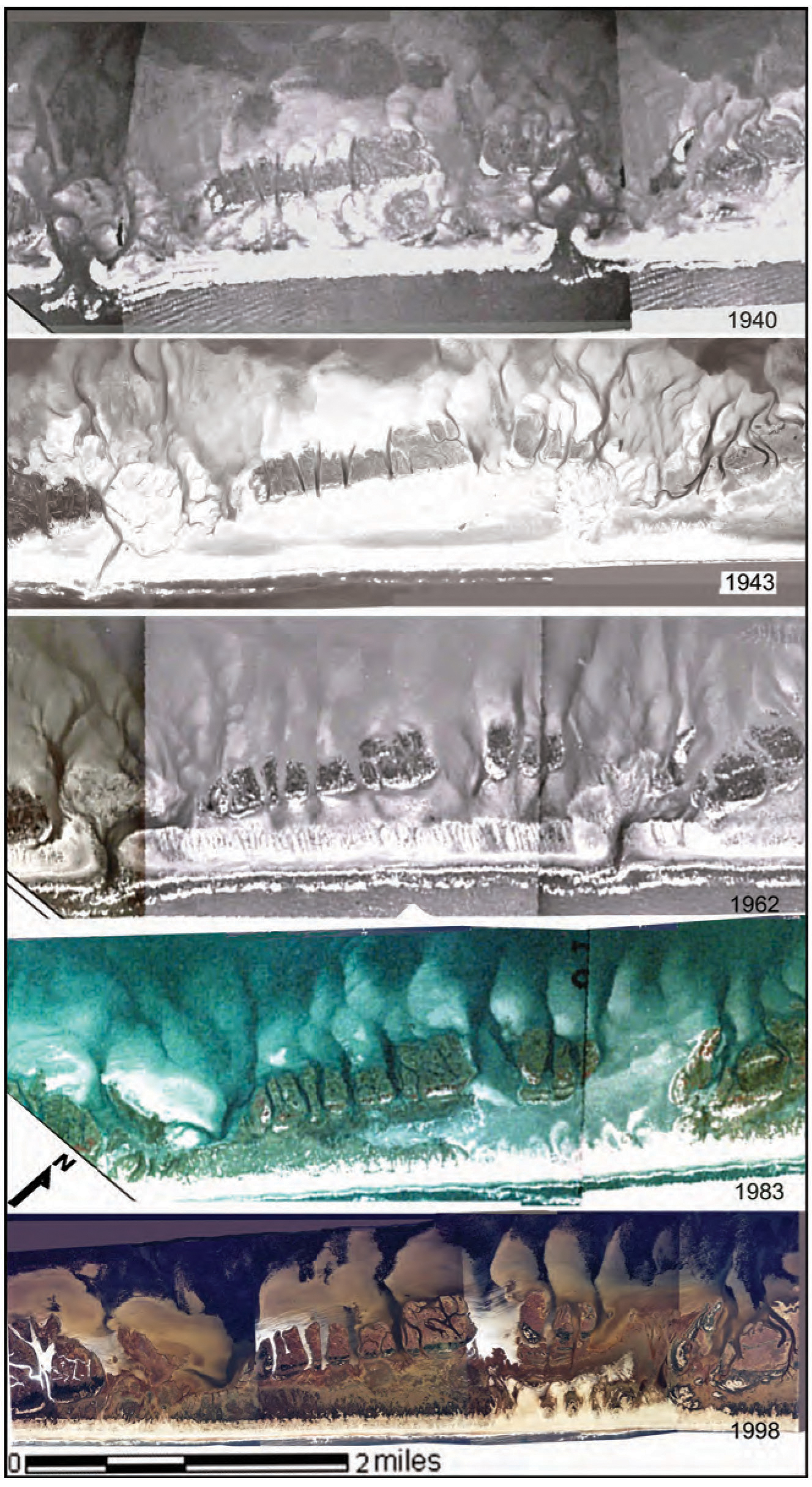
A sequence of five georeferenced aerial photographs of the area of North Core Banks between Swash Inlet (left) and Whalebone Inlet (right).
A sequence of five georeferenced aerial photographs of the area of North Core Banks
between Swash Inlet (left) and Whalebone Inlet (right). Vegetation in 1940, 1943, and 1962 is limited to back-barrier
platform marshes and submerged sand bodies. The 1983 and 1998 aerial photographs show increasing amounts of
subaerial, inter-tidal, and submerged aquatic vegetation with diminishing amounts of bare sand as overwash initially
increased island elevation, which in turn decreased overwash and allowed vegetative cover to increase.
Permission must be secured from the individual copyright owners to reproduce any copyrighted materials contained within this website. Digital assets without any copyright restrictions are public domain.
Figure 26 from Riggs and Ames (2007).
Public domain:Full Granting Rights
Image
Cape Lookout National Seashore, Code: CALO
Cape Lookout National Seashore, Carteret County, North Carolina
Latitude: 34.9581985473633, Longitude: -76.1900024414063
Latitude: 34.9581985473633, Longitude: -76.1900024414063
07/20/2017
07/20/2017
Public Can View
Thursday, August 5, 2021 10:45:20 AM
Thursday, August 5, 2021 1:02:23 PM
12_CALO_Riggs_Ames_2007_sir2006-5309 51.jpg
Thursday, July 20, 2017 10:15:39 PM
jpg
1.7 MB
Scenic