Select Item below to DOWNLOAD - Once item is selected, right click and choose 'save as'
56033fac-fb09-4faa-a593-48408cf07216
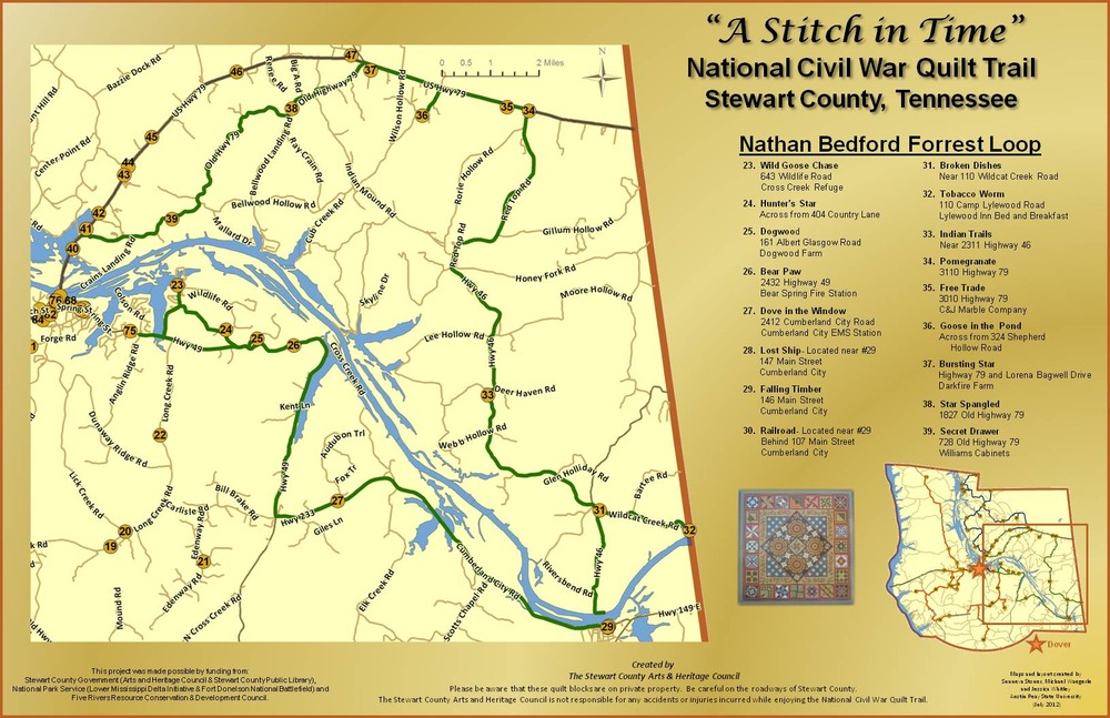
NB Forrest Loop of the Quilt Trail
map for the NB Forrest Loop
Information and addresses for the Forrest Loop
Permission must be secured from the individual copyright owners to reproduce any copyrighted materials contained within this website. Digital assets without any copyright restrictions are public domain.
Stewart County Arts and Heritage Council
Public domain:Full Granting Rights
Image
Fort Donelson National Battlefield, Code: FODO
Fort Donelson National Battlefield
Latitude: 36.4912986755371, Longitude: -87.8561325073242
Latitude: 36.4912986755371, Longitude: -87.8561325073242
01/01/2006
01/01/0001
Public Can View
Wednesday, March 31, 2021 12:35:28 PM
Wednesday, March 31, 2021 12:35:28 PM
Slide3.JPG
Monday, January 1, 0001 12:00:00 AM
jpg
263.0 kB
Scenic