Select Item below to DOWNLOAD - Once item is selected, right click and choose 'save as'
51a35b9e-f22b-4cd9-bdc0-a9245c030a45
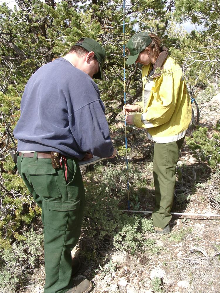
Establishing vegetation plot at Grand Canyon NP
Vegetation plots are valuable in measuring the effects of fire on vegetation. Plots are established by recording species, distribution and age of plants found within it.
Establishing base line
U.S. National Park Service
Establishing plot baseline
Permission must be secured from the individual copyright owners to reproduce any copyrighted materials contained within this website. Digital assets without any copyright restrictions are public domain.
Public domain
Fire ecology, ()
, Fire research, ()
, Vegetation monitoring protocols, ()
, Photo points for vegetation monitoring, ()
, Fire research, ()
, Vegetation monitoring protocols, ()
, Photo points for vegetation monitoring, ()
Image
Grand Canyon National Park, Code: GRCA
Fire and Aviation Management Program, Code: FIRE
Fire and Aviation Management Program, Code: FIRE
Grand Canyon National Park, Arizona
Latitude: 36.3291397094727, Longitude: -112.790603637695
Latitude: 36.3291397094727, Longitude: -112.790603637695
Legacy NPS Focus Record ID : 232788
09/08/2005
05/02/2001
Digital camera image (JPG format; 1.01 MB; 1536 x 2048 pixels ; 72 dpi; 24 bit color)
Public Can View
Thursday, September 8, 2005 4:18:06 PM
Wednesday, August 9, 2017 7:42:11 PM
GRCA- Monitoring-20010502_2.jpg
CASIO CASIO, QV-3000EX
10000/3731343 sec at f / 4
7.13 mm
Wednesday, May 2, 2001 9:51:00 PM
jpg
1.1 MB
Events