Fire and Aviation Management Program, Code: FIRE
Latitude: 37.2234992980957, Longitude: -108.500999450684
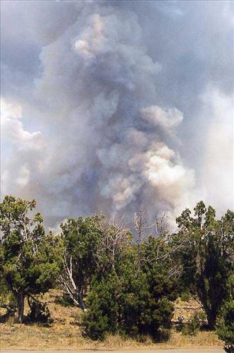
Intense burning with heavy gray and black smoke and flames during the Bircher fire, Mesa Verde National Park, July 2000
Intense burning with heavy gray and black smoke and flames during the Bircher fire, Mesa Verde National Park, July 2000
Intense burning with heavy gray and black smoke and flames during the Bircher fire, Mesa Verde National Park, July 2000
Intense burning with heavy gray and black smoke and flames during the Bircher fire, Mesa Verde National Park, July 2000
Intense burning with heavy gray and black smoke and flames during the Bircher fire, Mesa Verde National Park, July 2000
Intense burning with heavy gray and black smoke and flames during the Bircher fire, Mesa Verde National Park, July 2000
Intense burning with heavy gray and black smoke and flames during the Bircher fire, Mesa Verde National Park, July 2000