Select Item below to DOWNLOAD - Once item is selected, right click and choose 'save as'
4e3a2e77-c266-4442-8f30-04475c557640
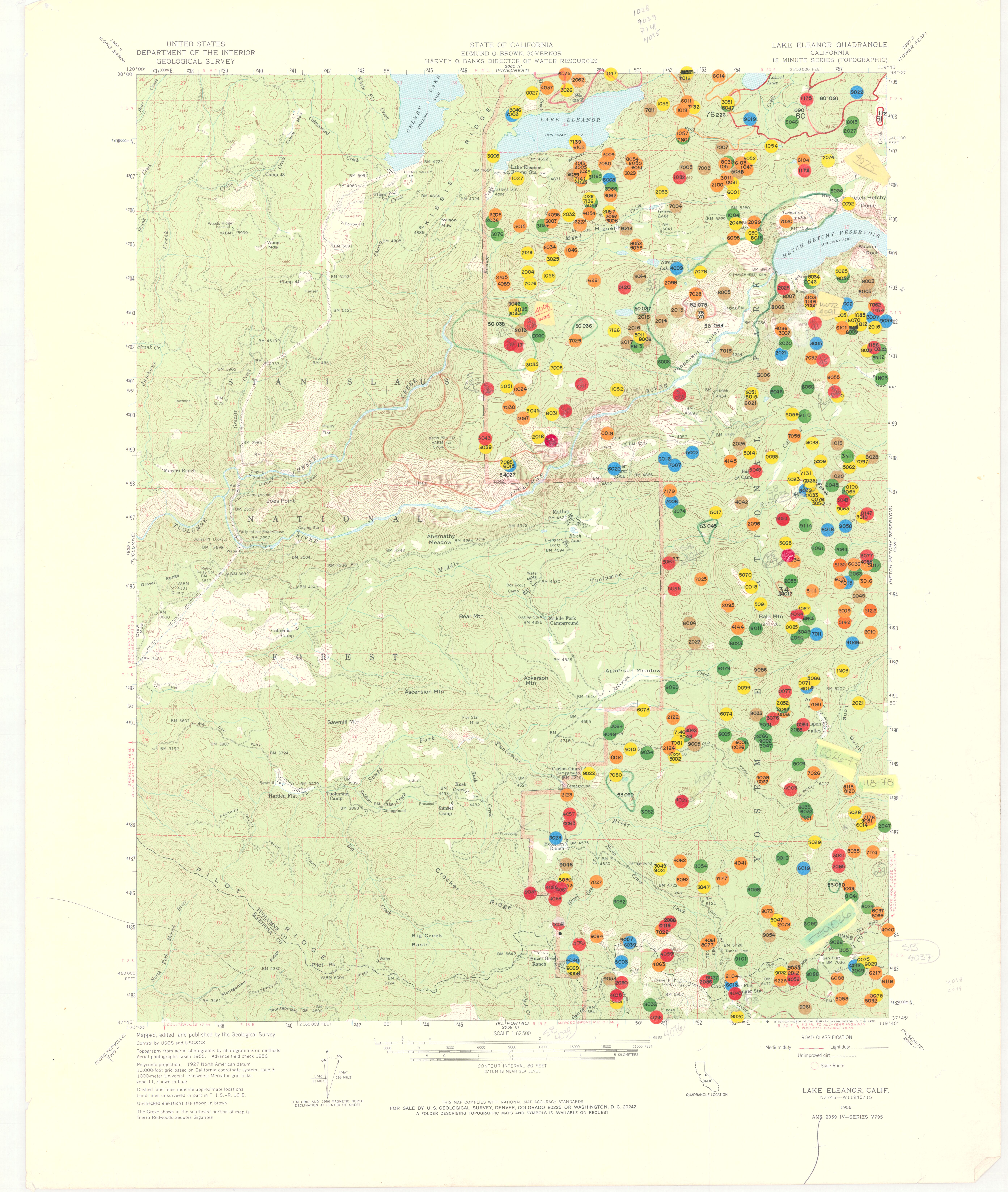
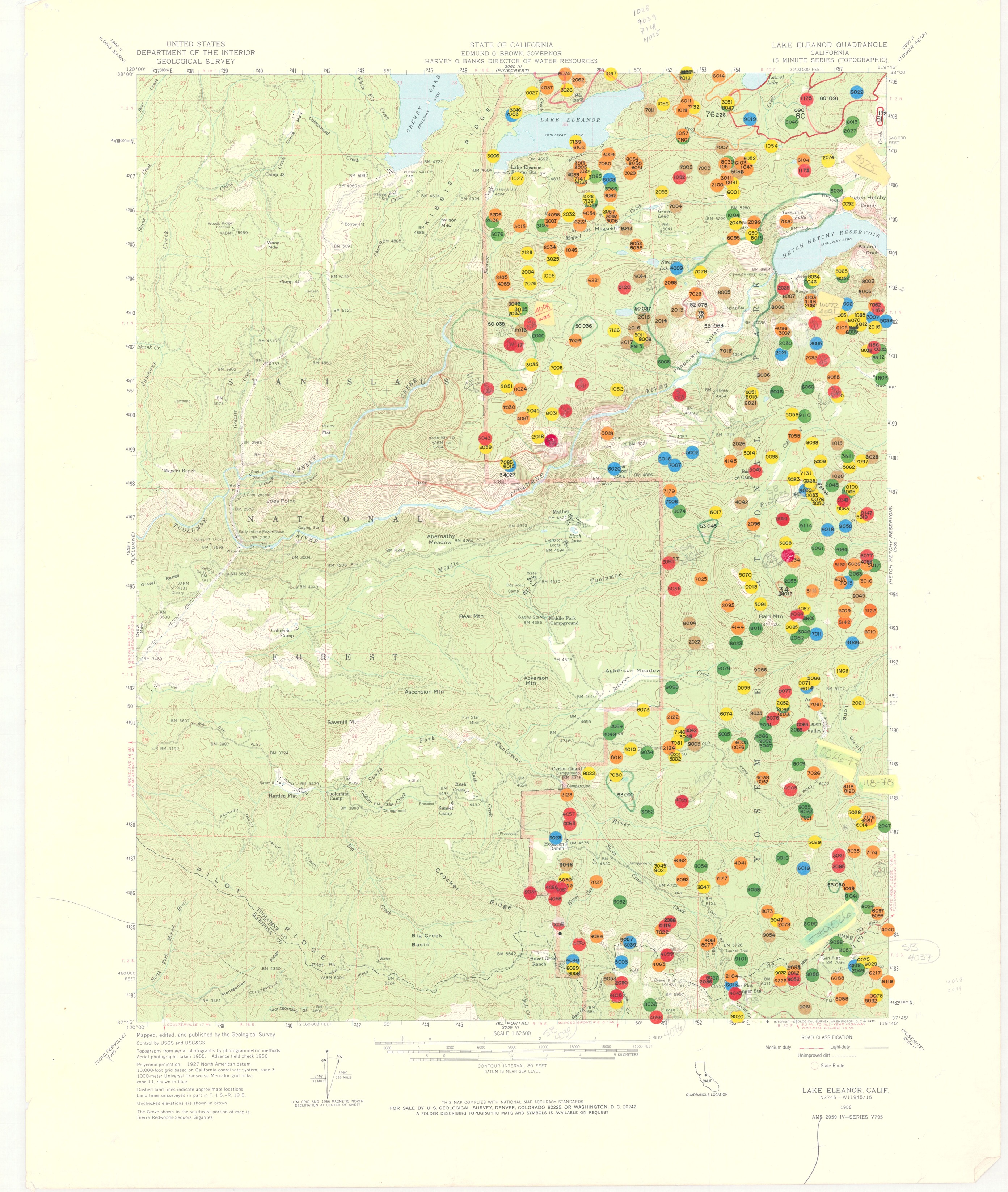
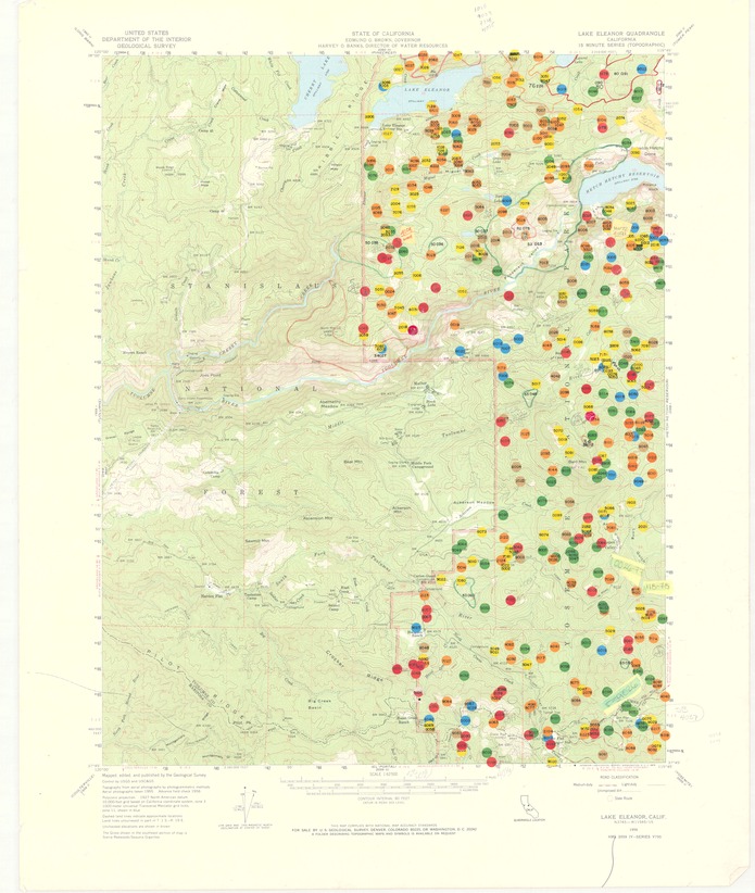
Lake Eleanor Quadrangle California
Lake Eleanor Quadrangle California
Topographic map of the Lake Eleanor Quadrangle with numbered multicolored dots signifying lightning fires in different decades
Item Number: YOSEAR001117D
Contact Yosemite National Park for more copyright information and use
Public domain:This digital asset is in the public domain. When using this asset for any purpose, including online, credit:'Courtesy U.S. National Parks'
Image
Yosemite National Park, Code: YOSE
Yosemite National Park, California
Latitude: 37.8399200439453, Longitude: -119.540397644043
Latitude: 37.8399200439453, Longitude: -119.540397644043
1985
01/01/1985 - 12/30/1985
Type: paper; Dimensions: 22 x 18; Condition: good
YOSE Location: E3 DR4 F3
Public Can View
Person: Archivist
Organization: US National Park Service
Address: Yosemite National Park Archives, PO Box 700-W, El Portal, CA 95318
Email: yose_archives@nps.gov
Organization: US National Park Service
Address: Yosemite National Park Archives, PO Box 700-W, El Portal, CA 95318
Email: yose_archives@nps.gov
Friday, July 22, 2022 9:35:22 PM
Friday, July 22, 2022 9:35:22 PM
YOSEAR001117D.tif
tif
68.8 MB
Scenic
,
Map