Select Item below to DOWNLOAD - Once item is selected, right click and choose 'save as'
48b39d07-12c1-4f50-b190-45e2dc9287cd
NERI.3053.UP.2017
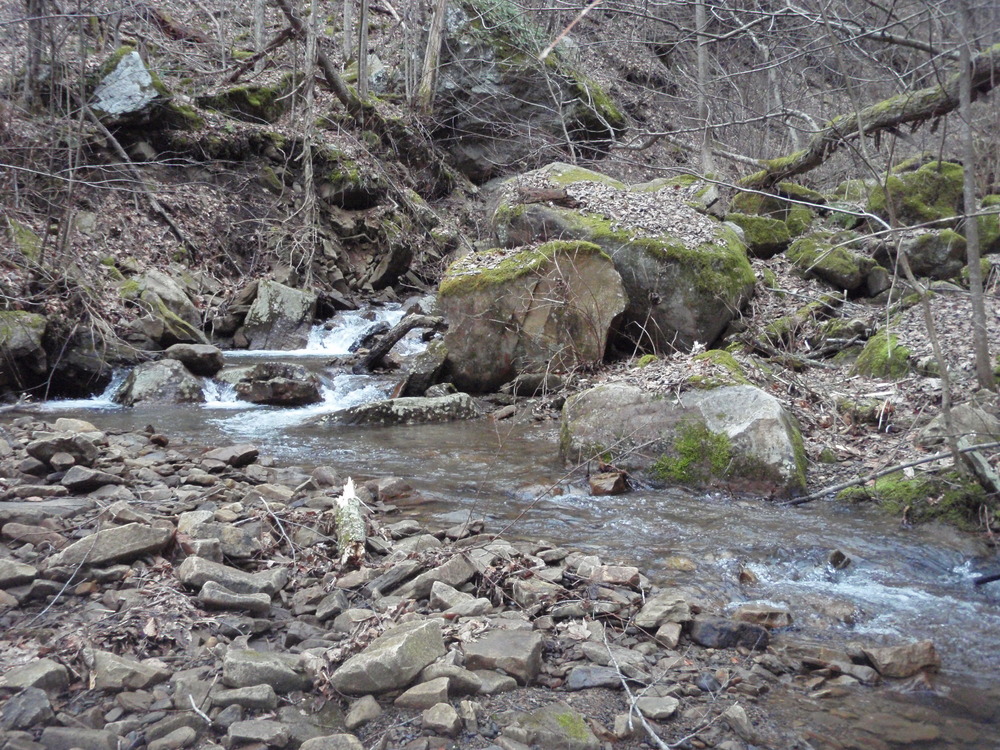
Site visit photo showing the upstream (UP) or downstream (DN) view of a wadeable stream reach taken during benthic macroinvertebrate monitoring at New River Gorge National Park and Preserve.
Site visit photo showing the upstream (UP) or downstream (DN) view of a wadeable stream reach taken during benthic macroinvertebrate monitoring at New River Gorge National Park and Preserve.
U.S. National Park Service
This digital asset is in the public domain. When using this asset for any purpose, including online, use: Photo Credit: U.S. National Park Service.
Photo Credit: National Park Service
Public domain
Slater Creek 13 - NERI.3053, (ERMN Stream Site Name)
, NERI.3053, (ERMN Stream Site ID)
, NERI.3053.UP, (ERMN Stream Site Up and Down)
, ERMN Benthic Macroinvertebrate Monitoring, (ERMN Project Name)
, NERI.3053, (ERMN Stream Site ID)
, NERI.3053.UP, (ERMN Stream Site Up and Down)
, ERMN Benthic Macroinvertebrate Monitoring, (ERMN Project Name)
Image
New River Gorge National Park and Preserve, Code: NERI
Eastern Rivers and Mountains Network, Code: ERMN
Eastern Rivers and Mountains Network, Code: ERMN
New River Gorge National Park and Preserve, West Virginia
Latitude: 37.840259552002, Longitude: -80.9897079467773
Latitude: 37.840259552002, Longitude: -80.9897079467773
Title: NPS DataStore Project
URL: https://irma.nps.gov/DataStore/Reference/Profile/2229360
Title: Eastern Rivers and Mountains Network Website
URL: https://www.nps.gov/im/ermn/index.htm
URL: https://irma.nps.gov/DataStore/Reference/Profile/2229360
Title: Eastern Rivers and Mountains Network Website
URL: https://www.nps.gov/im/ermn/index.htm
2017/03/06
01/01/2017 - 12/30/2017
Public Can View
Organization: Eastern Rivers and Mountains Network
Position: Data Manager
Position: Data Manager
Friday, August 9, 2024 2:55:32 PM
Friday, August 9, 2024 2:55:32 PM
NERI.3053.UP.2017.JPG
jpg
3.0 MB
Monitoring