Select Item below to DOWNLOAD - Once item is selected, right click and choose 'save as'
46bd4415-3b83-41b1-9076-0b506afb8c4d
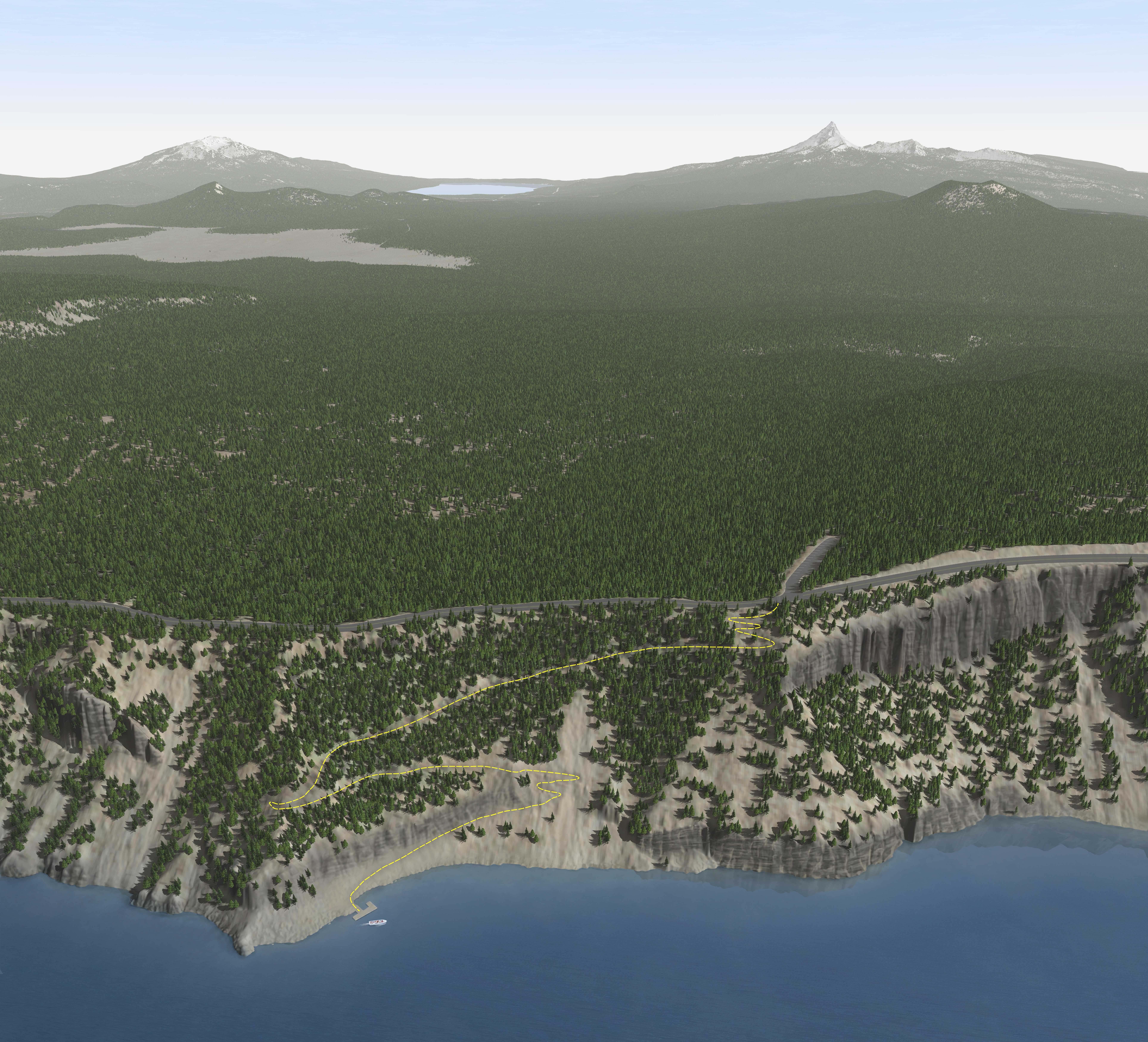
Cleetwood Cove 3D Trail Map without labels - Crater Lake National Park
3D view of Cleetwood Cove Trail in Crater Lake National Park in Oregon. A square landscape full of tree-topped cliffs and slopes leads down to a deep blue body of water. Dense forest fills in the middle ground, while pale mountain peaks structure the faded horizon.
Screen-viewable file; Adobe print production files can be downloaded from the Compressed zip Version link
Map Projection: 3D; Map Type: trail
U.S. National Park Service
The National Park Service maps are government produced and are in the public domain. Anyone may, without restriction under U.S. copyright laws: Reproduce the work in print or digital form; Create derivative works; Perform the work publicly; Display the work; Distribute copies or digitally transfer the work to the public by sale or other transfer of ownership, or by rental, lease, or lending. Please note, a user who modifies and/or republishes National Park Service maps are responsible for any problems encountered with the maps, due to their change or modification.
Public domain
Document
Crater Lake National Park, Code: CRLA
Crater Lake National Park, Oregon
Latitude: 42.9442710876465, Longitude: -122.135299682617
Latitude: 42.9442710876465, Longitude: -122.135299682617
2018-06-25
Public Can View
Person: Harpers Ferry Center
Organization: US National Park Service
Address: Harpers Ferry Center, Harpers Ferry, WV
Email: HFC_Cartography@nps.gov
Organization: US National Park Service
Address: Harpers Ferry Center, Harpers Ferry, WV
Email: HFC_Cartography@nps.gov
Monday, April 25, 2022 4:32:23 PM
Friday, September 26, 2025 11:34:44 PM
CRLArelief6.pdf
pdf
39.3 MB
Map