Select Item below to DOWNLOAD - Once item is selected, right click and choose 'save as'
4299de1f-fcf7-436d-ad58-ff91a4d2f4b6
BLUE.1003.DN.2012
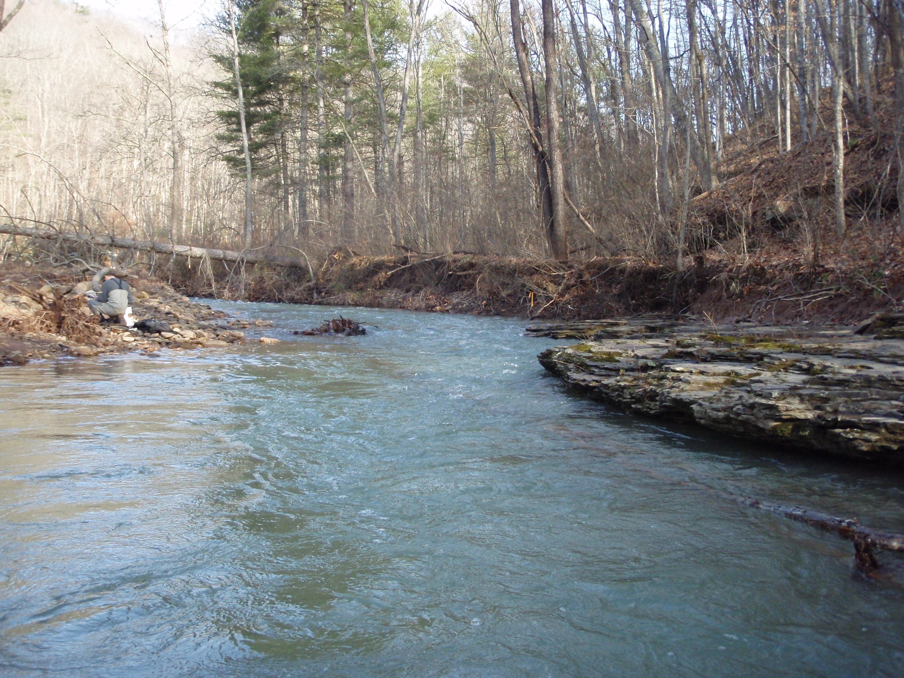
Site visit photo showing the upstream (UP) or downstream (DN) view of a wadeable stream reach taken during benthic macroinvertebrate monitoring at Bluestone National Scenic River.
Site visit photo showing the upstream (UP) or downstream (DN) view of a wadeable stream reach taken during benthic macroinvertebrate monitoring at Bluestone National Scenic River.
U.S. National Park Service
This digital asset is in the public domain. When using this asset for any purpose, including online, use: Photo Credit: U.S. National Park Service.
Photo Credit: National Park Service
Public domain
Little Bluestone River - BLUE.1003, (ERMN Stream Site Name)
, BLUE.1003, (ERMN Stream Site ID)
, BLUE.1003.DN, (ERMN Stream Site Up and Down)
, ERMN Benthic Macroinvertebrate Monitoring, (ERMN Project Name)
, BLUE.1003, (ERMN Stream Site ID)
, BLUE.1003.DN, (ERMN Stream Site Up and Down)
, ERMN Benthic Macroinvertebrate Monitoring, (ERMN Project Name)
Image
Bluestone National Scenic River, Code: BLUE
Eastern Rivers and Mountains Network, Code: ERMN
Eastern Rivers and Mountains Network, Code: ERMN
Bluestone National Scenic River, West Virginia
Latitude: 37.5690498352051, Longitude: -80.983757019043
Latitude: 37.5690498352051, Longitude: -80.983757019043
Title: NPS DataStore Project
URL: https://irma.nps.gov/DataStore/Reference/Profile/2229360
Title: Eastern Rivers and Mountains Network Website
URL: https://www.nps.gov/im/ermn/index.htm
URL: https://irma.nps.gov/DataStore/Reference/Profile/2229360
Title: Eastern Rivers and Mountains Network Website
URL: https://www.nps.gov/im/ermn/index.htm
2012/03/08
01/01/2012 - 12/30/2012
Public Can View
Organization: Eastern Rivers and Mountains Network
Position: Data Manager
Position: Data Manager
Friday, August 9, 2024 3:32:30 PM
Friday, August 9, 2024 3:32:30 PM
BLUE.1003.DN.2012.JPG
jpg
3.1 MB
Monitoring