Select Item below to DOWNLOAD - Once item is selected, right click and choose 'save as'
402e8f88-c6a8-4801-829b-23cea6c8dd74
MAP
This image was captured during the WASO funded Digital Imaging Project aimed at increasing access to NPS collections through digital photography. http://www.nps.gov/hfc/products/cons/museum-mgmt.htm
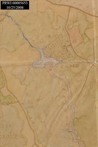
Detail
U.S. National Park Service
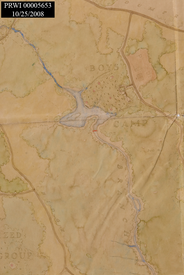
LAND USE. 1937. HAND DRAWN.. LIST STREAMS AND ROADS. OTHER COMMENT.<CRIN INK DESCRIBING ATTRIBUTES.<CR<CR<CR<CRCATALOG NUMBER ON BACK OF PRINT. GLOVES REQUIRED IN HANDLING.
Permission must be secured from the individual copyright owners to reproduce any copyrighted materials contained within this website. Digital assets without any copyright restrictions are public domain.
Public domain:For further image information contact:Prince William Forest Park, 18100 Park Headquarters Road Triangle, VA 22172-1644 Tel. (703) 221-4706.
American History, ()
, Recreation and Park Enjoyment, ()
, Civilian Conservation Corps, ()
, image1.nsp.gov, ()
, Recreation and Park Enjoyment, ()
, Civilian Conservation Corps, ()
, image1.nsp.gov, ()
Image
Prince William Forest Park, Code: PRWI
Dumfries, Prince William Forest Park, Prince William County, Virginia
Latitude: 38.589900970459, Longitude: -77.3863983154297
Latitude: 38.589900970459, Longitude: -77.3863983154297
10/25/2007
10/25/2007
Public Can View
Thursday, January 20, 2011 11:13:02 AM
Wednesday, August 9, 2017 6:04:56 PM
PRWI00005653_D_5.jpg
NIKON CORPORATION NIKON CORPORATION, NIKON D200
1/100 sec at f / 16
50 mm
ISO 100
Thursday, October 25, 2007 3:12:42 PM
jpg
405.5 kB
Museum
,
Map