Select Item below to DOWNLOAD - Once item is selected, right click and choose 'save as'
3f7b04f4-749d-4366-af0b-73304a055e97
1954 Monument Map
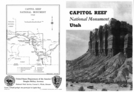
black and white image of a map and rock formations.
1954 Capitol Reef National Monument brochure
Permission must be secured from the individual copyright owners to reproduce any copyrighted materials contained within this website. Digital assets without any copyright restrictions are public domain.
NPS
Public domain:Full Granting Rights
Image
Capitol Reef National Park, Code: CARE
Capitol Reef National Park, Utah
Latitude: 38.1704216003418, Longitude: -111.14330291748
Latitude: 38.1704216003418, Longitude: -111.14330291748
06/08/2015
06/08/2015
Sunday, January 31, 2021 4:57:09 PM
Sunday, January 31, 2021 4:57:09 PM
1954 care map 300dpi.jpg
Monday, June 8, 2015 11:20:39 PM
jpg
4.0 MB
Scenic