Latitude: 26.7036590576172, Longitude: -97.3406829833984
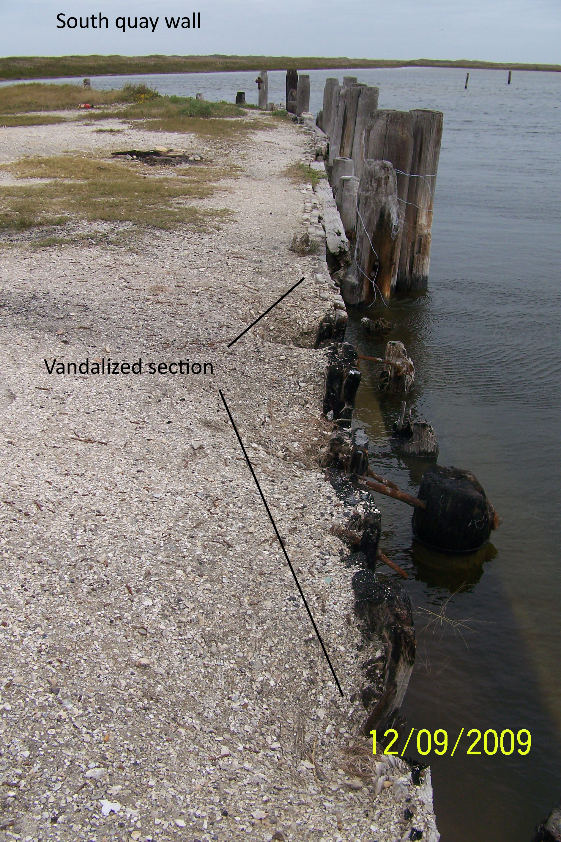
State of a quay wall at Yarborough Pass/Murdock's Landing as of Dec. 2009
State of a quay wall at Yarborough Pass/Murdock's Landing as of Dec. 2009
State of a quay wall at Yarborough Pass/Murdock's Landing as of Dec. 2009
State of a quay wall at Yarborough Pass/Murdock's Landing as of Dec. 2009
State of a quay wall at Yarborough Pass/Murdock's Landing as of Dec. 2009
State of a quay wall at Yarborough Pass/Murdock's Landing as of Dec. 2009
State of a quay wall at Yarborough Pass/Murdock's Landing as of Dec. 2009
State of a quay wall at Yarborough Pass/Murdock's Landing as of Dec. 2009
State of a quay wall at Yarborough Pass/Murdock's Landing as of Dec. 2009
State of a quay wall at Yarborough Pass/Murdock's Landing as of Dec. 2009
State of a quay wall at Yarborough Pass/Murdock's Landing as of Dec. 2009
State of a quay wall at Yarborough Pass/Murdock's Landing as of Dec. 2009
State of a quay wall at Yarborough Pass/Murdock's Landing as of Dec. 2009