Select Item below to DOWNLOAD - Once item is selected, right click and choose 'save as'
3bfbe287-d6f6-4bd9-9cc5-7344d3991621
March 06 2024 Cima Rd Closed Piute Gorge Closed.png
Road Conditions Map of Mojave National Preserve Effective February 27th 2024. All Roads open except for Cima Road, Hart Mine Road, Mojave Road at Soda Lake, and Upper Carruthers Canyon Road. Railroad crossing at Kelso Subject to 1 hour delays. Kelbaker Road south of Interstate 40 Closed.
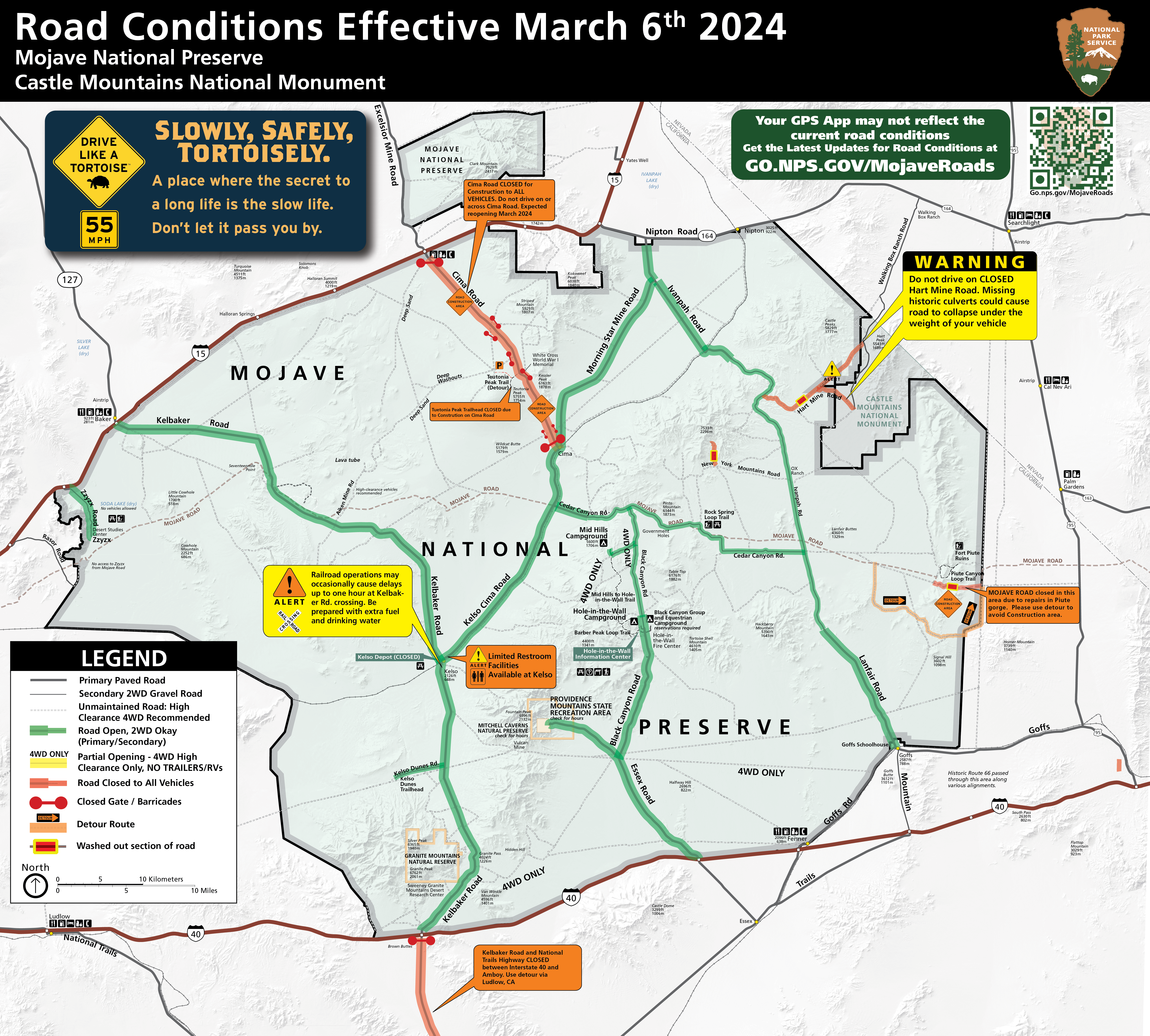
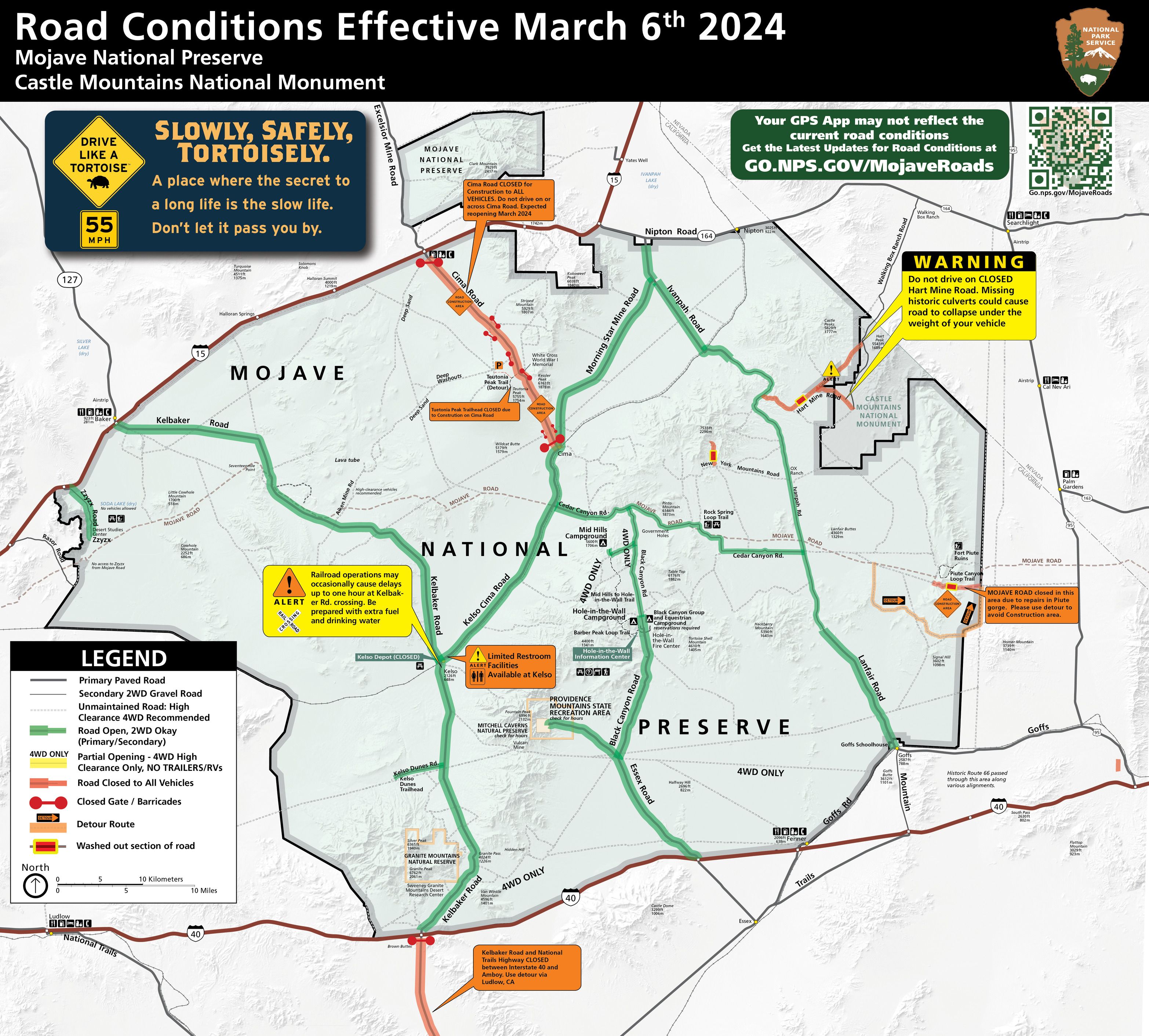
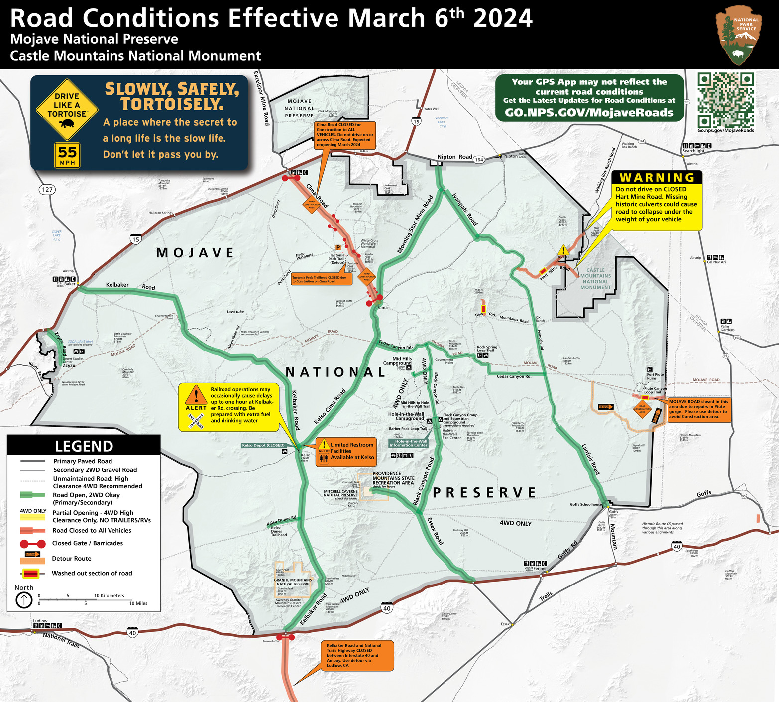
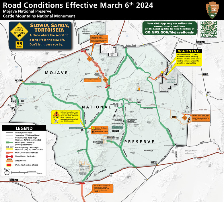
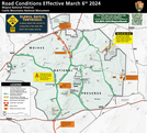
Road Conditions Map for Mojave National Preserve and Castle Mountains National Monument, Effective March 6th, 2024
Permission must be secured from the individual copyright owners to reproduce any copyrighted materials contained within this website. Digital assets without any copyright restrictions are public domain.
NPS / MOJA Media
Public domain:Full Granting Rights
Image
Castle Mountains National Monument, Code: CAMO
Mojave National Preserve, Code: MOJA
Mojave National Preserve, Code: MOJA
Castle Mountains National Monument
Mojave National Preserve, San Bernardino County, California
Latitude: 35.114200592041, Longitude: -115.514999389648
Mojave National Preserve, San Bernardino County, California
Latitude: 35.114200592041, Longitude: -115.514999389648
Public Can View
Thursday, March 7, 2024 1:20:45 AM
Thursday, March 7, 2024 1:24:02 AM
March 06 2024 Cima Rd Closed Piute Gorge Closed-01.png
png
15.9 MB
Scenic