Select Item below to DOWNLOAD - Once item is selected, right click and choose 'save as'
3b381dab972c475cba307be2003662f9
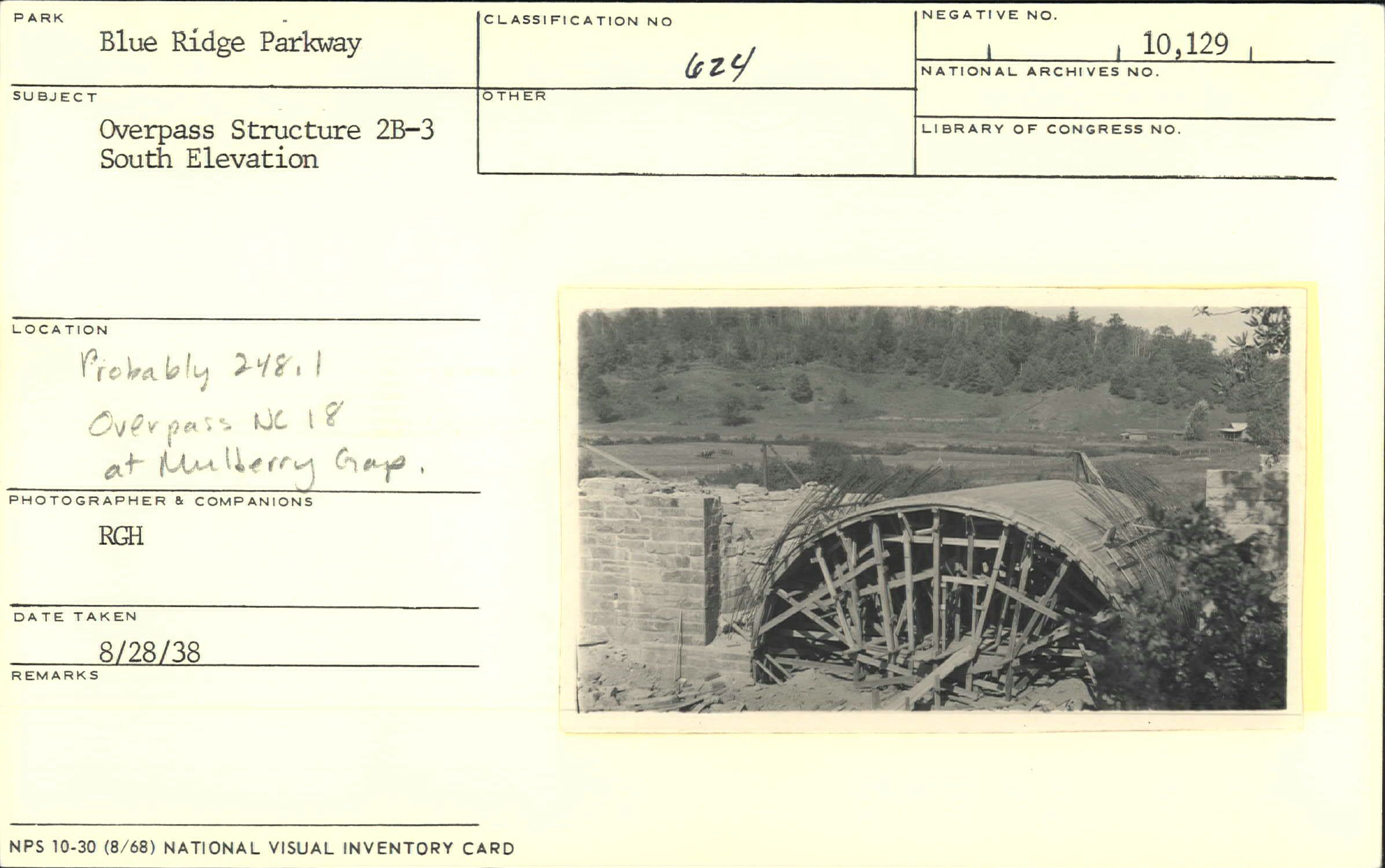
Overpass structure, south elevation
Overpass structure, south elevation
Section 2-D, NC Route 18 Overpass, Milepost 248.1
U.S. National Park Service
Permission must be secured from the individual copyright owners to reproduce any copyrighted materials contained within this website.
RGH
Public domain
Image
Blue Ridge Parkway, Code: BLRI
Milepost 248, Blue Ridge Parkway
Blue Ridge Parkway
Latitude: 36.4365005493164, Longitude: -81.070556640625
Blue Ridge Parkway
Latitude: 36.4365005493164, Longitude: -81.070556640625
August 28, 1938
08/28/1938
Public Can View
Organization: US National Park Service
Role: Museum Curator
Address: Blue Ridge Parkway Headquarters
Email: blri_info@nps.gov
Role: Museum Curator
Address: Blue Ridge Parkway Headquarters
Email: blri_info@nps.gov
Friday, February 7, 2020 2:05:39 PM
Friday, February 7, 2020 2:05:39 PM
0057_MP248_1.tif
tif
10.8 MB
Scenic
,
Historic