Select Item below to DOWNLOAD - Once item is selected, right click and choose 'save as'
3985c969-72ad-41ec-ab47-585f85c8619f
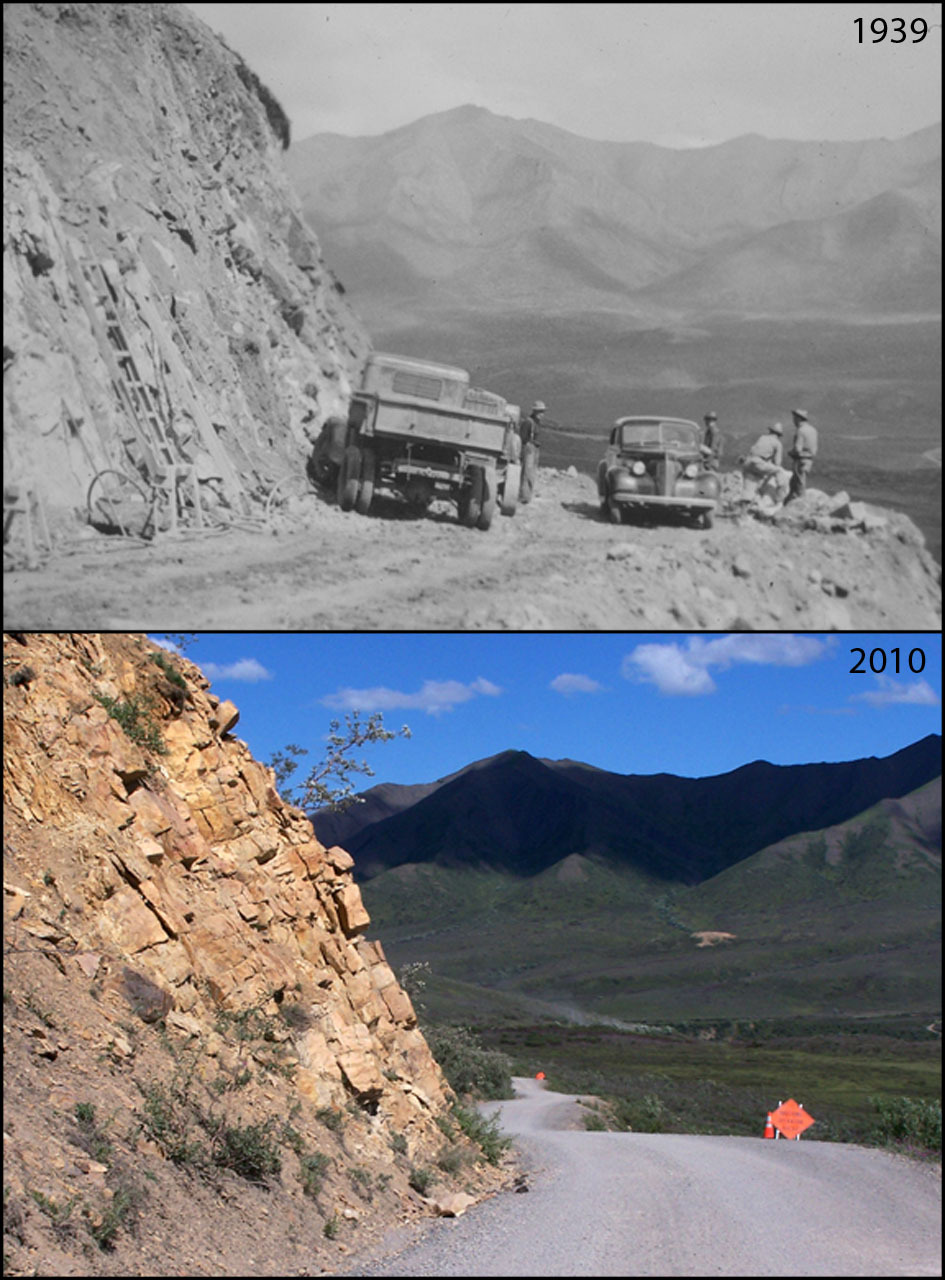
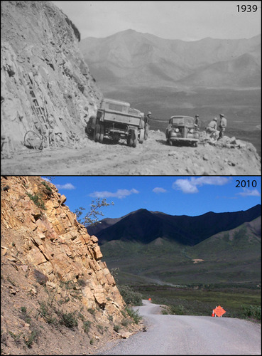
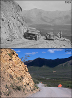
Human Development and Impacts at East Fork Toklat River: 1939-2010
A photo pair showing Human Development and Impacts at East Fork Toklat River: 1939-2010
This photo pair features a section of the park road as it climbs over Polychrome Pass. Originally called the "Highline" section, the route over Polychrome Pass was chosen not for ease of road building but for its scenic views. Significant blasting was required to make room for the roadbed, and careful measures were taken to prevent the roadbed from slumping down slope. The work is remarkable considering the remoteness of the site, the short season of favorable weather, and the equipment of the time.
Original year: 1939; Rephoto year: 2010
U.S. National Park Service
Photos and photo pairs are pre-approved for educational use ONLY. To use them in educational products, credit them the same way as they are credited on the website, Photo Credit: Original photographer: Denali NP&P Museum Coll. 25-1; Rephoto photographer: Tamás Szerényi. For any other use beyond education, contact Denali National Park and Preserve for additional copyright information on specific images of interest.
Original photographer: Denali NP&P Museum Coll. 25-1; Rephoto photographer: Tamás Szerényi
Restrictions apply on use and/or reproduction
Image
Denali National Park and Preserve, Code: DENA
East Fork Toklat River, Alaska Range mountains, Alaska
Latitude: 63.543066, Longitude: -149.800133
Denali National Park and Preserve, Alaska
Latitude: 63.3182792663574, Longitude: -150.602905273438
Latitude: 63.543066, Longitude: -149.800133
Denali National Park and Preserve, Alaska
Latitude: 63.3182792663574, Longitude: -150.602905273438
2012/06/25
Public Can View
Person: Digital Manager
Organization: US National Park Service
Address: Denali National Park and Preserve, P.O. Box 9, Denali Park, AK 99755
Organization: US National Park Service
Address: Denali National Park and Preserve, P.O. Box 9, Denali Park, AK 99755
Thursday, June 6, 2024 4:54:08 PM
Thursday, June 6, 2024 4:54:08 PM
CultRes_067.jpg
jpg
260.6 kB
Scenic
,
Historic
,
Monitoring