Select Item below to DOWNLOAD - Once item is selected, right click and choose 'save as'
39322B00-1DD8-B71B-0B5916DF87E03071
Site Map
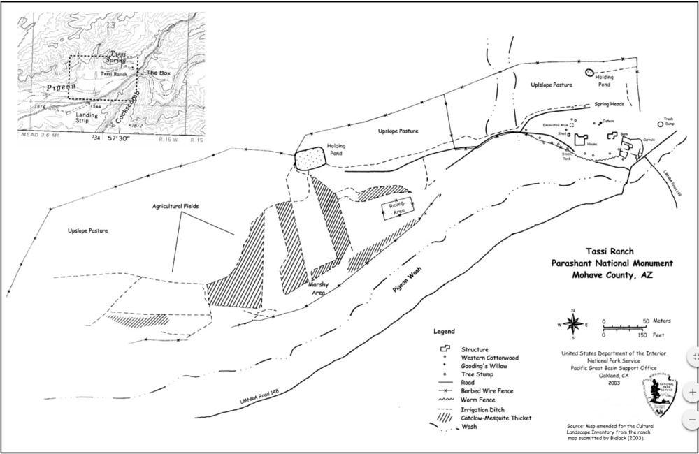
a site map of Tassi Ranch, showing the location of ranch features
In order to take advantage of the Tassi Springs, the only viable water source in the area, the ranch core features, including the house, barn, corrals, and agricultural fields, are all clustered together.
U.S. National Park Service
Permission must be secured from the individual copyright owners to reproduce any copyrighted materials contained within this website. Digital assets without any copyright restrictions are public domain.
NPS
Public domain:Full Granting Rights
Image
NPS-wide, Code: NPS
Public Can View
Tuesday, January 9, 2018 3:16:05 PM
Tuesday, January 9, 2018 3:16:05 PM
3934FB8E-1DD8-B71B-0B02A5E37C7A5B33.PNG
png
318.2 kB
Scenic