Select Item below to DOWNLOAD - Once item is selected, right click and choose 'save as'
375abf0a-5e1b-46b2-92e1-c3be57851894
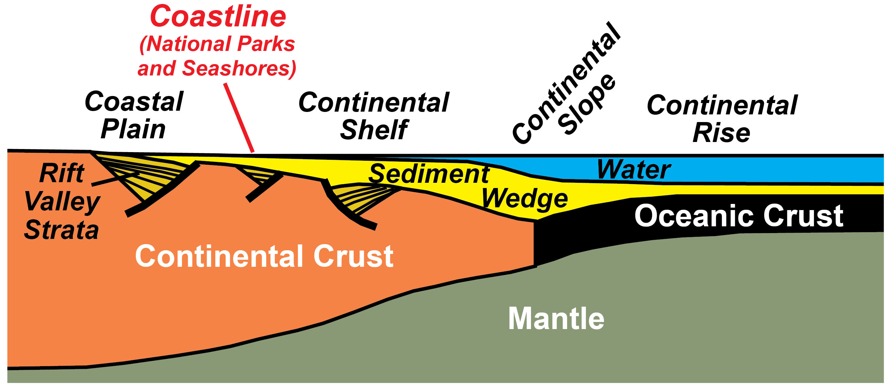
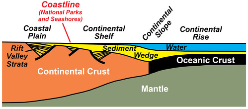
Topography of a Passive Continental Margin
illustration of the upper layers of the earth showing a passive continental margin
The topography and bathymetry (underwater topography) of a passive continental margin result from the underlying transition from continental to oceanic crust. Because the oceanic crust is thinner (and thus less buoyant) than the continental crust, its surface is lower. As the subsiding ocean basin floods with water, a wedge of sedimentary layers (sandstone, shale, and limestone) accumulates along the continental margin. Older sedimentary and volcanic layers fill rift valleys that formed when the continent initially ripped apart. The ocean water is shallow over the rifted continental crust, a region termed the continental shelf. The water level deepens along the continental slope to the continental rise, which overlies the thinner oceanic crust. Beaches and barrier islands on the coastal plain and continental shelf of the Atlantic Ocean and Gulf of Mexico are the sites of several National Park Service sites.
Permission must be secured from the individual copyright owners to reproduce any copyrighted materials contained within this website. Digital assets without any copyright restrictions are public domain.
Modified from “Parks and Plates: The Geology of our National Parks, Monuments and Seashores,” by Robert J. Lillie, New York, W. W. Norton and Company, 298 pp., 2005, www.amazon.com/dp/0134905172.
Public domain:Full Granting Rights
Image
Geologic Resources Division, Code: GRD
12/04/2019
12/04/2019
Public Can View
Friday, January 31, 2020 12:57:56 PM
Friday, January 31, 2020 12:57:56 PM
illustration of a passive continental margin@10x.jpg
Thursday, December 5, 2019 12:42:29 AM
jpg
406.9 kB
Scenic