Select Item below to DOWNLOAD - Once item is selected, right click and choose 'save as'
37223ca25c004becb8061cc32cbfc201
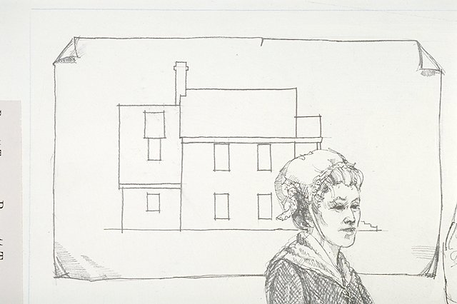
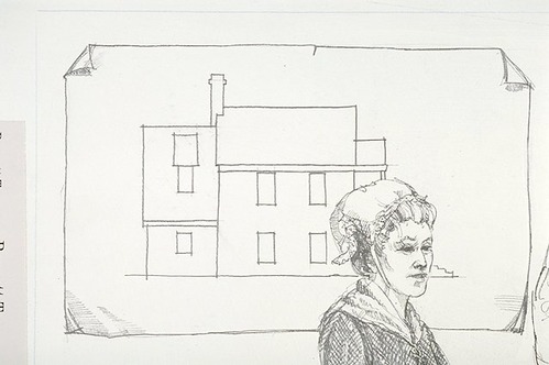
Elevation drawing of the Levi and Ann Bennett Tavern.
Elevation drawing of the Levi and Ann Bennett Tavern.
Illustrated with IMS #04534 Dennis Simon's illustration based on a drawing in Albert Manucy's "Town Model Specifications."; Abbr=WE
U.S. National Park Service
Reflective Art
Government owns art and all reproduction rights.
Public domain
Image
Fort Frederica National Monument, Code: FOFR
Fort Frederica National Monument, Glynn County, Georgia
Latitude: 31.2236003875732, Longitude: -81.3898010253906
Latitude: 31.2236003875732, Longitude: -81.3898010253906
Image Management System : IMS 04533
20190904
01/01/1986 - 12/30/1986
Exhibit 15/Graphic # 15-5
I 13
Public Can View
Organization: Harpers Ferry Center
Address: Harpers Ferry Center, 67 Mather Place, Harpers Ferry, WV, 25425, 304-535-5050
Address: Harpers Ferry Center, 67 Mather Place, Harpers Ferry, WV, 25425, 304-535-5050
Wednesday, October 9, 2019 12:43:38 PM
Wednesday, October 9, 2019 12:43:38 PM
04533.JPG
jpg
41.6 kB
Museum