Select Item below to DOWNLOAD - Once item is selected, right click and choose 'save as'
361FE9C6D36C4A8D941A219EB74F42DC
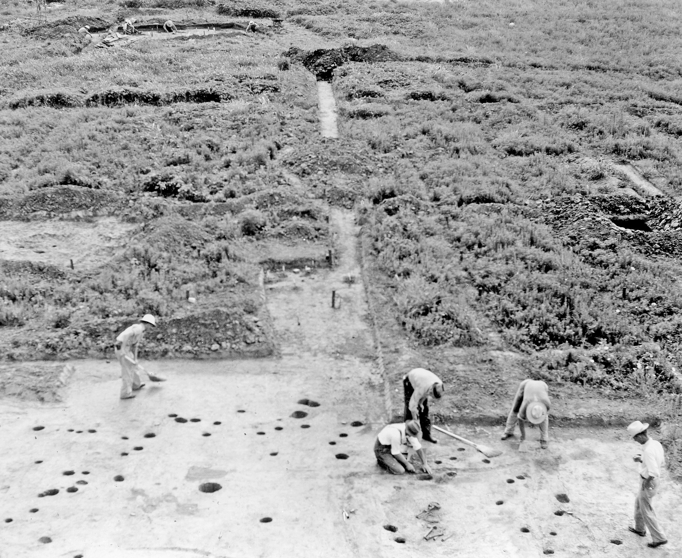
Excavation of Structures, Natchez Trace 1940s Archeological Survey
The crew (foreground) work on one of the eleven structures with rounded corners that were uncovered. The numerous post holes show that the structure was rebuilt or repaired several times, which indicates years of use.
U. S. National Park Service
Park staff access only
Public domain
Image
Natchez Trace Parkway, Code: NATR
Natchez Trace Parkway
Latitude: 32.8700408935547, Longitude: -89.6542129516602
Latitude: 32.8700408935547, Longitude: -89.6542129516602
ANCS-plus : SEAC-00291
08/05/2015
01/01/1939 - 12/11/1946
Public Can View
Person: Jill Halchin
Organization: US National Park Service
Position: GIS Coordinator
Address: Southeast Archeological Center, Tallahassee FL
Email: jill_halchin@nps.gov
Organization: US National Park Service
Position: GIS Coordinator
Address: Southeast Archeological Center, Tallahassee FL
Email: jill_halchin@nps.gov
Sunday, January 29, 2017 1:59:21 PM
Wednesday, August 9, 2017 5:02:45 PM
ackia2blocks.tif
Sunday, January 1, 1939 5:01:59 PM
tif
3.7 MB
Inventory
,
Museum