Select Item below to DOWNLOAD - Once item is selected, right click and choose 'save as'
36063bbf-6037-44cd-856d-4ceb806db169
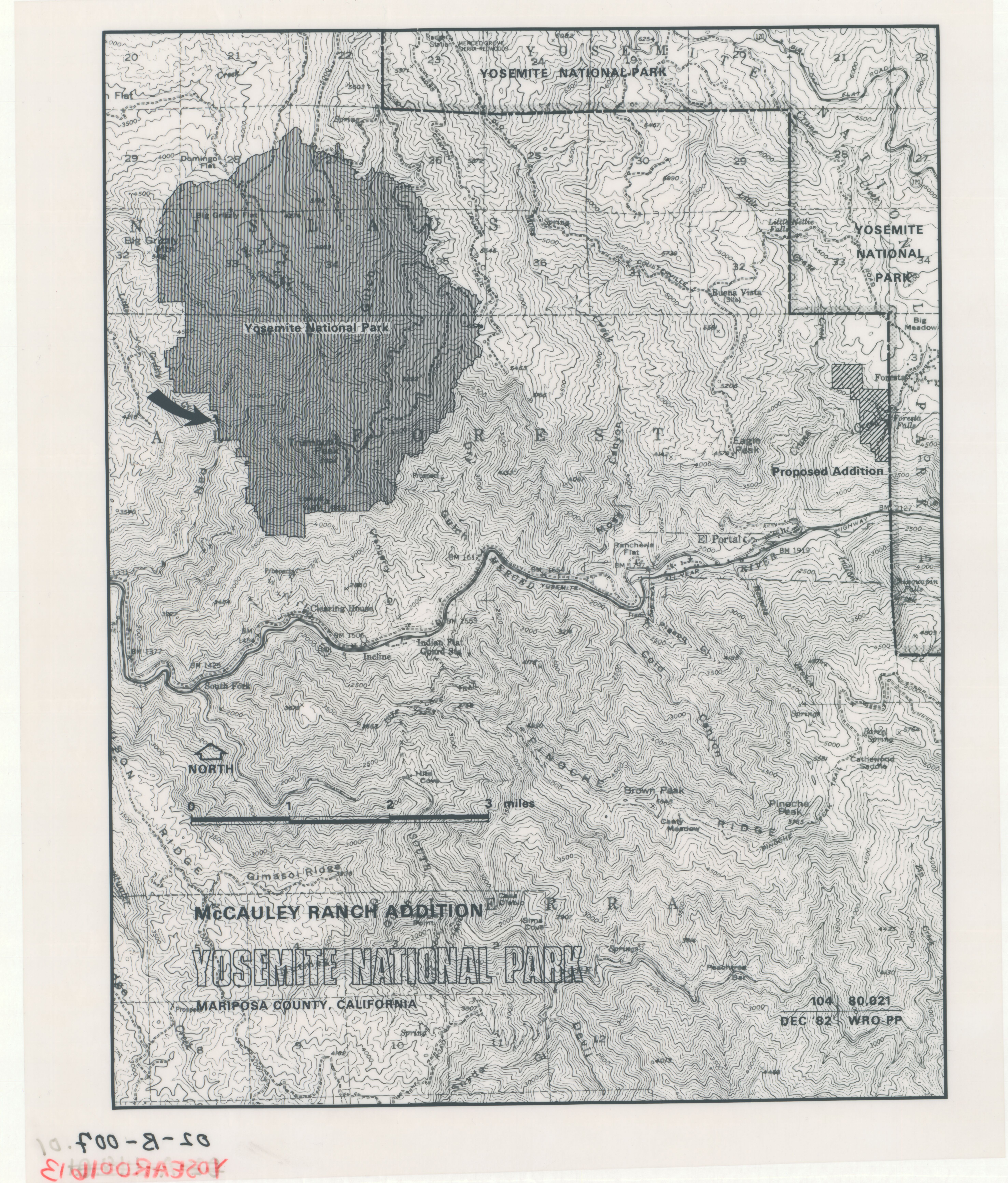
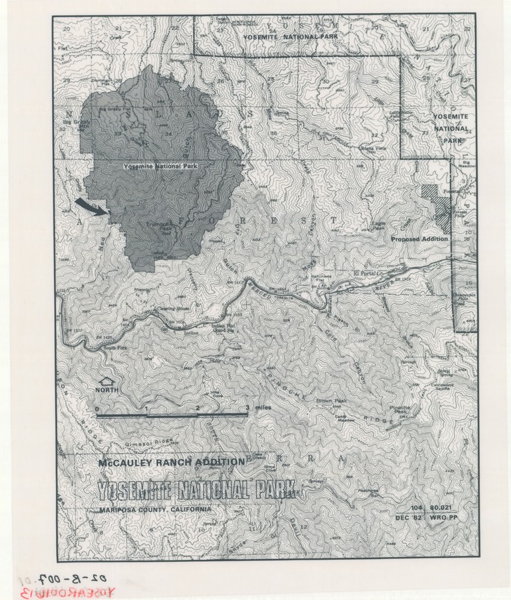
McCauley Ranch Addition
McCauley Ranch Addition
Map of Mariposa County and Yosemite National Park with addition marked.
Item Number: YOSEAR001613, AlternateId: 02-B-007, 104/80021
Contact Yosemite National Park for more copyright information and use
Public domain:This digital asset is in the public domain. When using this asset for any purpose, including online, credit:'Courtesy U.S. National Parks'
104/80021, (YOSE TIC Number)
Image
Yosemite National Park, Code: YOSE
Yosemite National Park, California
Yosemite National Park, California
Latitude: 37.8399200439453, Longitude: -119.540397644043
Yosemite National Park, California
Latitude: 37.8399200439453, Longitude: -119.540397644043
1982
01/01/1982 - 12/30/1982
Type:polyester overlay, Dimensions: 12 x 10, Condition: good
YOSE Location: E4 DR7 F2
Public Can View
Person: Archivist
Organization: US National Park Service
Address: Yosemite National Park Archives, PO Box 700-W, El Portal, CA 95318
Email: yose_archives@nps.gov
Organization: US National Park Service
Address: Yosemite National Park Archives, PO Box 700-W, El Portal, CA 95318
Email: yose_archives@nps.gov
Friday, August 4, 2023 2:15:59 PM
Friday, August 4, 2023 2:15:59 PM
YOSEAR001613.tif
tif
122.7 MB
Historic
,
Map