Select Item below to DOWNLOAD - Once item is selected, right click and choose 'save as'
355c87b1-9caf-4e73-8211-1ae35adb5867
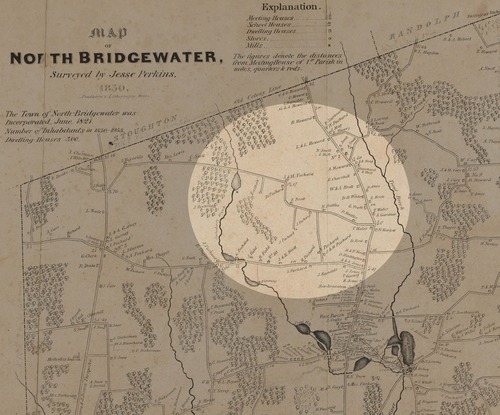
Plan of North Bridgewater
Map of North Bridgewater with a circular area highlighted in the middle.
Plan of North Bridgewater (now Brockton) made by Jesse Perkins, dated 1830.
This map image is used for the Luther Jotham (Patriot of Color) story map.
Digital Commonwealth states "no known copyright restrictions." See more information here: https://www.digitalcommonwealth.org/search/commonwealth:25152k20j
Jesse Perkins
Public domain:Digital Commonwealth states "no known copyright restrictions"
Image
Boston National Historical Park, Code: BOST
Boston National Historical Park, Suffolk County, Massachusetts
Latitude: 42.3734016418457, Longitude: -71.0557022094727
Latitude: 42.3734016418457, Longitude: -71.0557022094727
https://www.digitalcommonwealth.org/search/commonwealth:25152k20j
01/01/1830
01/01/0001
Public Can View
Organization: Digital Commonwealth
Tuesday, February 8, 2022 11:54:13 AM
Tuesday, February 8, 2022 12:01:31 PM
bridgewater map.jpg
Monday, January 1, 0001 12:00:00 AM
jpg
1.2 MB
Historic