Select Item below to DOWNLOAD - Once item is selected, right click and choose 'save as'
343fdedb-0ece-4433-aa0c-15b8a6a09894
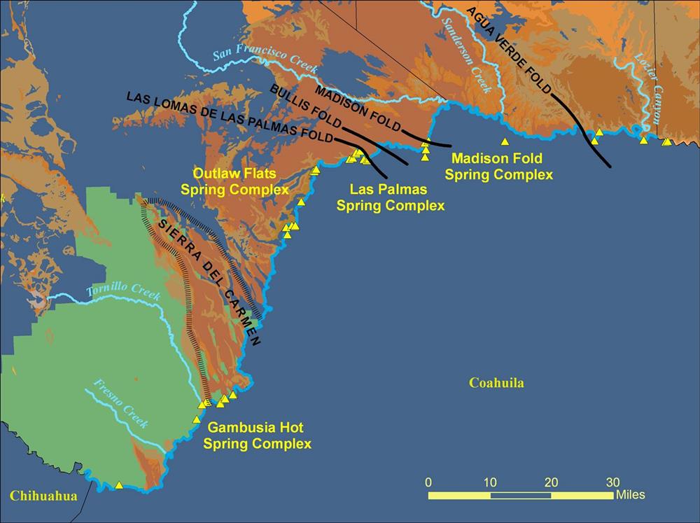
Maps for Edwards Trinity Aquifer
Permission must be secured from the individual copyright owners to reproduce any copyrighted materials contained within this website. Digital assets without any copyright restrictions are public domain.
Public domain
Image
Big Bend National Park, Code: BIBE
west texas, Big Bend National Park, Brewster County, Texas
Latitude: 29.2980003356934, Longitude: -103.230003356934
Latitude: 29.2980003356934, Longitude: -103.230003356934
Public Can View
Tuesday, March 31, 2009 2:59:36 PM
Wednesday, August 9, 2017 4:48:55 PM
BIBE-655d59cb5dd44b52bc5e80acf3eb8fe1.jpg
Monday, January 1, 0001 12:00:00 AM
jpg
156.2 kB
Map
,
Budget