Select Item below to DOWNLOAD - Once item is selected, right click and choose 'save as'
32e0eec4-8def-46f1-9444-ea2c3f16d0e3
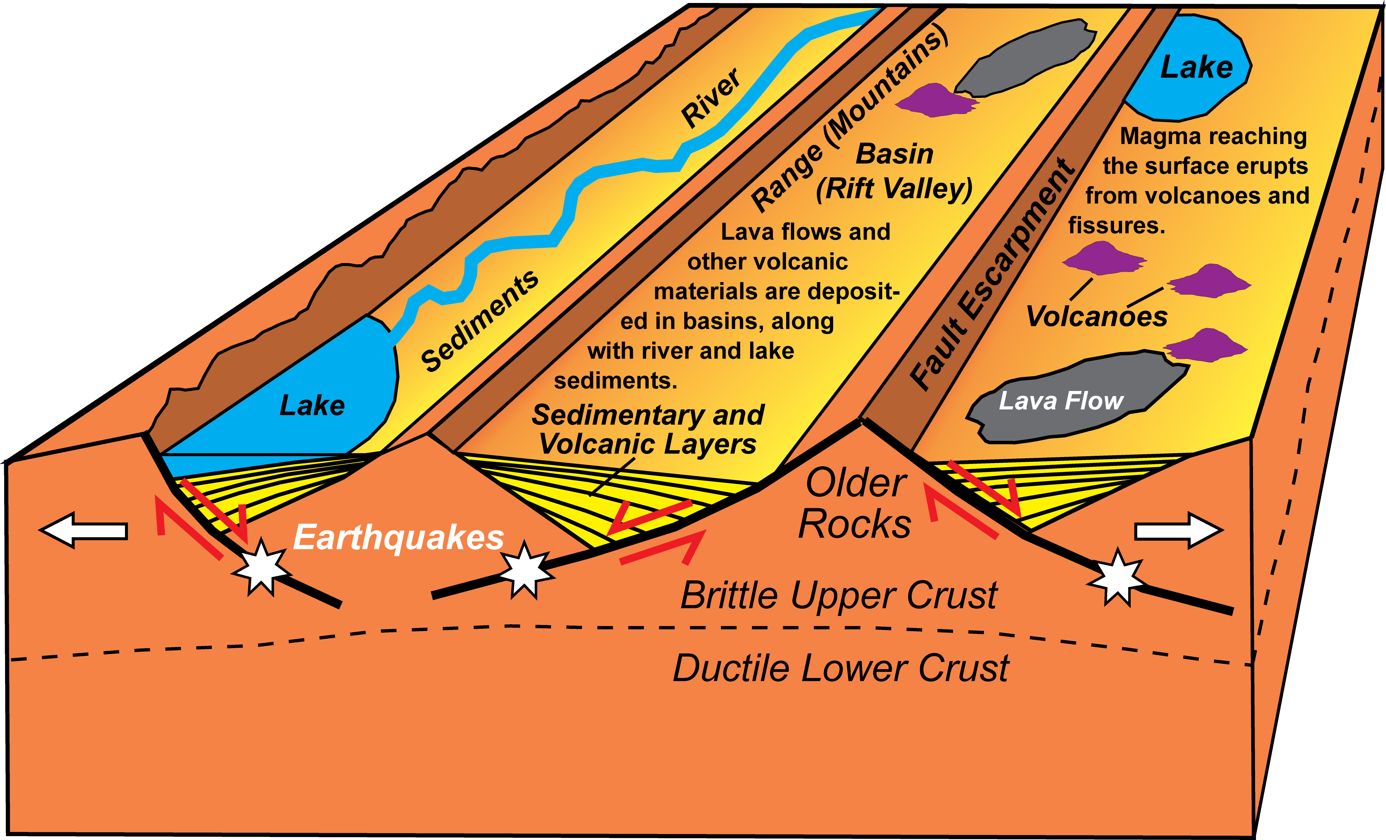
Continental Rift Block Diagram
alt="block diagram of earth's surface layers at continental rift zone"
Basin and Range topography develops over a few million years as fault lines move gradually or more abruptly during tens of thousands of earthquakes. Lakes pond against active fault escarpments where one side of a rift valley moves downward faster than the other. National Park Service sites in continental rift zones reveal long mountain ranges separated by deep valleys (basins) that are partially filled with sedimentary and volcanic material. Earthquakes (white stars) occur when the fault lines separating the basins and ranges suddenly let go.
Permission must be secured from the individual copyright owners to reproduce any copyrighted materials contained within this website. Digital assets without any copyright restrictions are public domain.
Modified from “Beauty from the Beast: Plate Tectonics and the Landscapes of the Pacific Northwest,” by Robert J. Lillie, Wells Creek Publishers, 92 pp., 2015, www.amazon.com/dp/1512211893.
Public domain:Full Granting Rights
Image
Geologic Resources Division, Code: GRD
09/26/2019
09/26/2019
Public Can View
Wednesday, October 9, 2019 10:07:34 AM
Wednesday, October 9, 2019 10:07:34 AM
continental rift block diagram@10x.jpg
Thursday, September 26, 2019 4:57:38 PM
jpg
4.2 MB
Scenic