Select Item below to DOWNLOAD - Once item is selected, right click and choose 'save as'
31cf9cc0-2f4e-45f4-afe8-6bb04e8a51d8
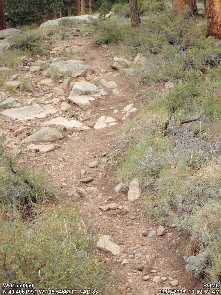
ROMO_PMIS 239783_BC-16 Black Canyon Lower_Before_Pic1
ROMO_PMIS 239783_BC-16 Black Canyon Lower_Before_Pic1
XP WO1550950
XP N 40° 24.372' W 105° 32.800'
Permission must be secured from the individual copyright owners to reproduce any copyrighted materials contained within this website. Digital assets without any copyright restrictions are public domain.
Public domain
Image
Intermountain Region, Code: IMR
Rocky Mountain National Park, Code: ROMO
Rocky Mountain National Park, Code: ROMO
BC-16 Black Canyon Trail, Rocky Mountain National Park, Larimer County, Colorado
Latitude: 40.4062, Longitude: -105.546669444445, Elevation: 0
Latitude: 40.4062, Longitude: -105.546669444445, Elevation: 0
09/05/2008 | ROMO_PMIS 239783_BC-16 Black Canyon Lower_Before_Pic1
09/05/2008
Public Can View
XP GPS-Photo Link - Version 4.0.49 - NPS Edition
Person: Kevin Soviak
Organization: ROMO
Position: Program Supervisor - Trails
Address: Rocky Mountain National Park, 1000 US Hwy 36, Estes Park, CO 80517
Email: kevin_soviak@nps.gov
Organization: ROMO
Position: Program Supervisor - Trails
Address: Rocky Mountain National Park, 1000 US Hwy 36, Estes Park, CO 80517
Email: kevin_soviak@nps.gov
Saturday, January 28, 2017 11:52:21 PM
Wednesday, August 9, 2017 4:29:37 PM
ROMO_PMIS 239783_BC-16 Black Canyon Lower_Before_Pic1.jpg
OLYMPUS IMAGING CORP. OLYMPUS IMAGING CORP., u790SW,S790SW
1/250 sec at f / 4.5
11.4 mm
ISO 200
Friday, September 5, 2008 4:52:52 PM
jpg
1.5 MB
Inventory
,
Budget