Select Item below to DOWNLOAD - Once item is selected, right click and choose 'save as'
31636ba6-eed1-4c36-811b-6d44ddf15916
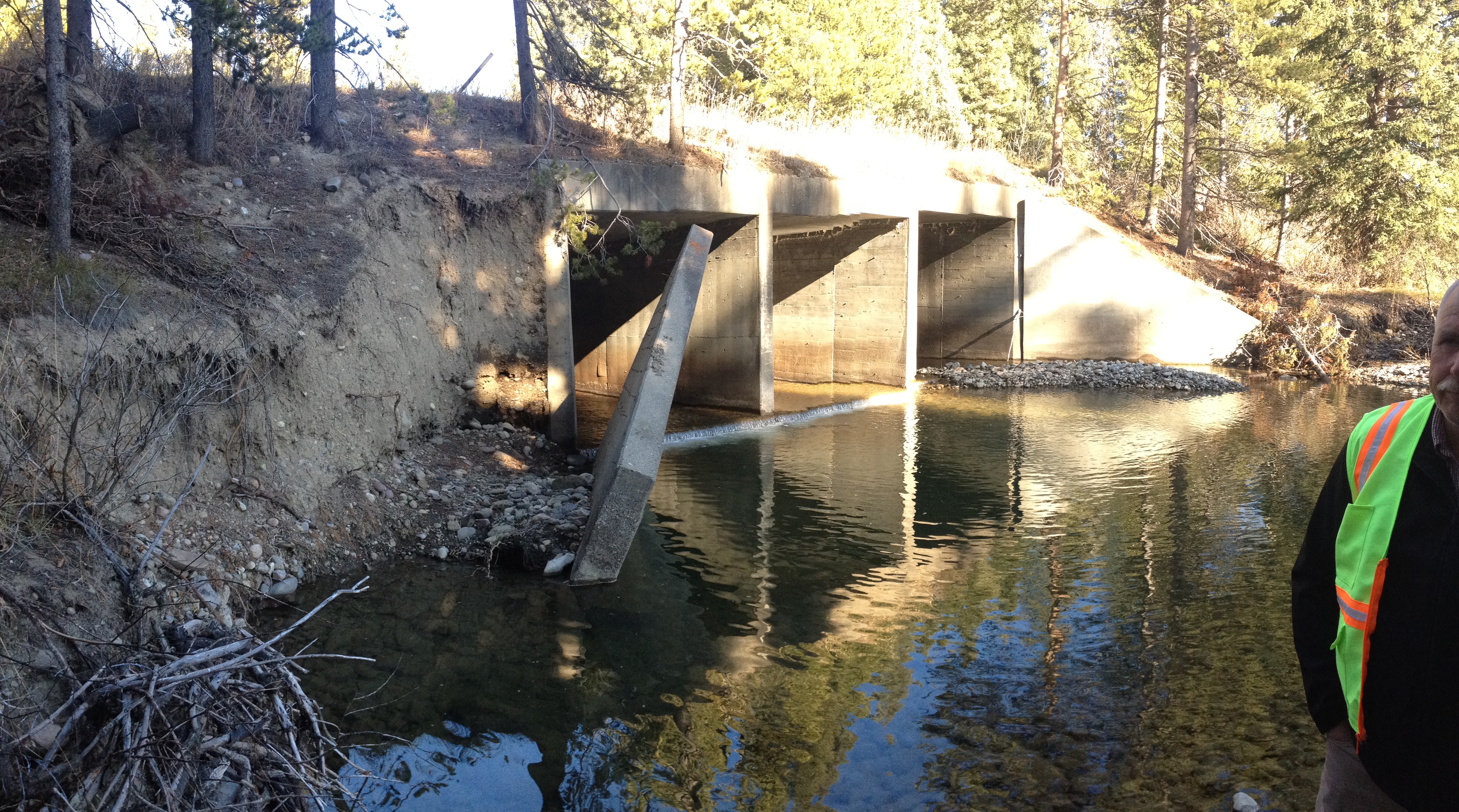
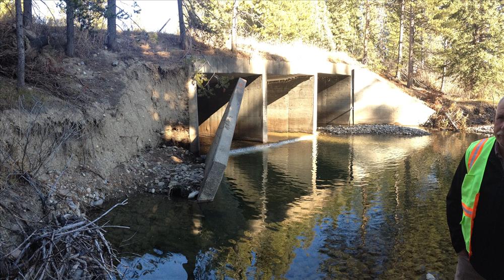
Failed Wingwall Arizona Creek Culvert Grand Teton National Park
Photo showing the failed wingwall and the eroded bank which supports the North Park Road over Arizona Creek in Grand Teton National Park.
Permission must be secured from the individual copyright owners to reproduce any copyrighted materials contained within this website. Digital assets without any copyright restrictions are public domain.
Public domain
Roads and highways, (NPS Focus Subject Thesaurus)
Image
Grand Teton National Park, Code: GRTE
Grand Teton National Park, Teton County, Wyoming
Latitude: 43.8181991577148, Longitude: -110.705001831055
Latitude: 43.8181991577148, Longitude: -110.705001831055
Legacy NPS Focus Record ID : 524236
11/03/2014
10/01/2014 - 10/30/2014
Public Can View
Friday, November 7, 2014 11:06:05 AM
Wednesday, August 9, 2017 4:28:37 PM
GRTE-1aa5766b312c49e2b970a3c0885c204a.jpg
Apple Apple, iPhone 4S 200, iPhone 4S back camera 4.28mm f/2.4
1/356 sec at f / 2.4
4.28 mm
ISO 200
Monday, November 3, 2014 9:41:15 PM
jpg
5.0 MB